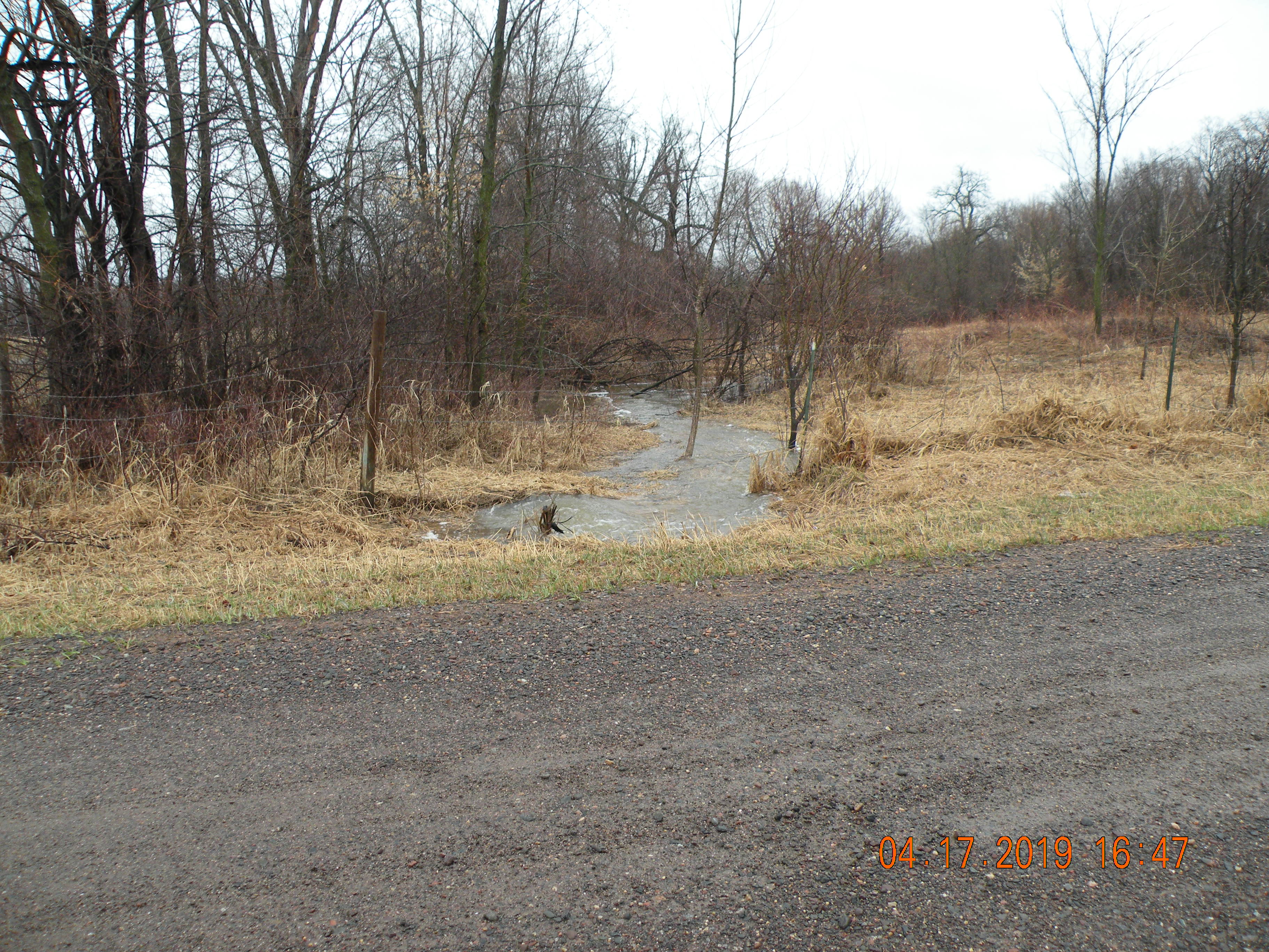
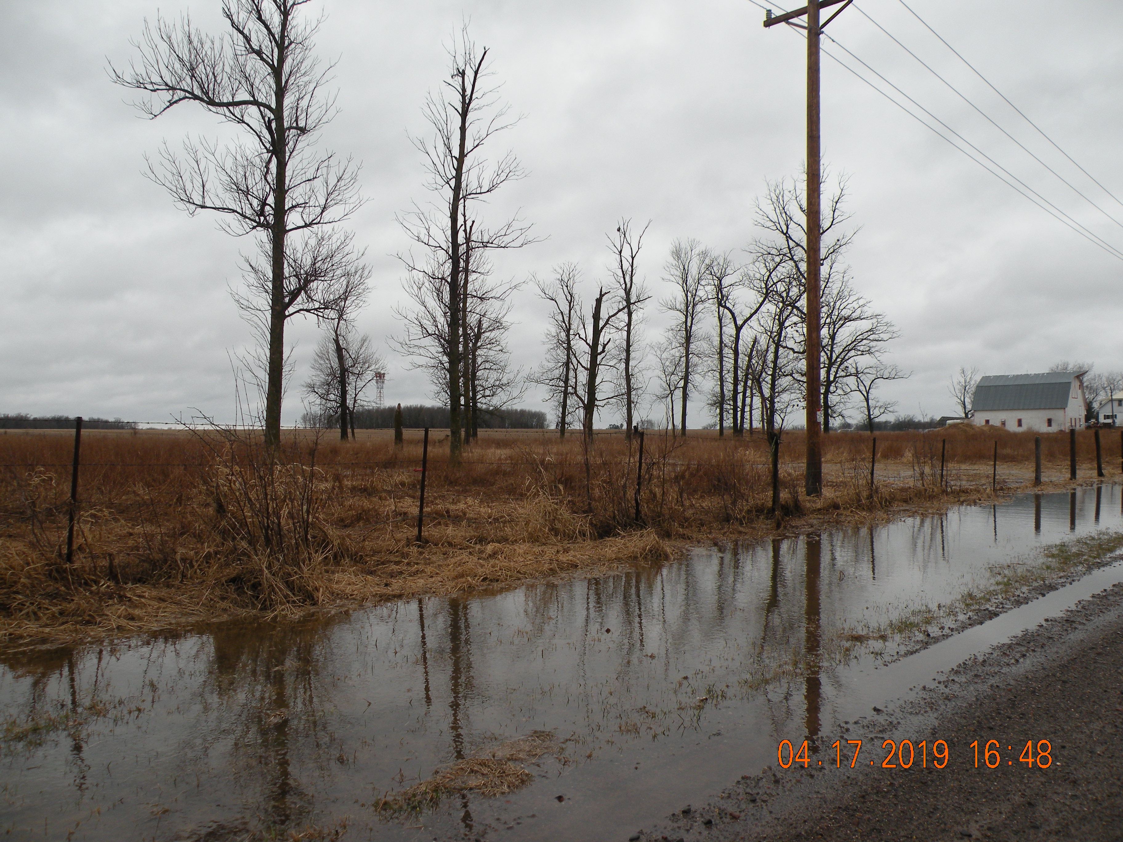
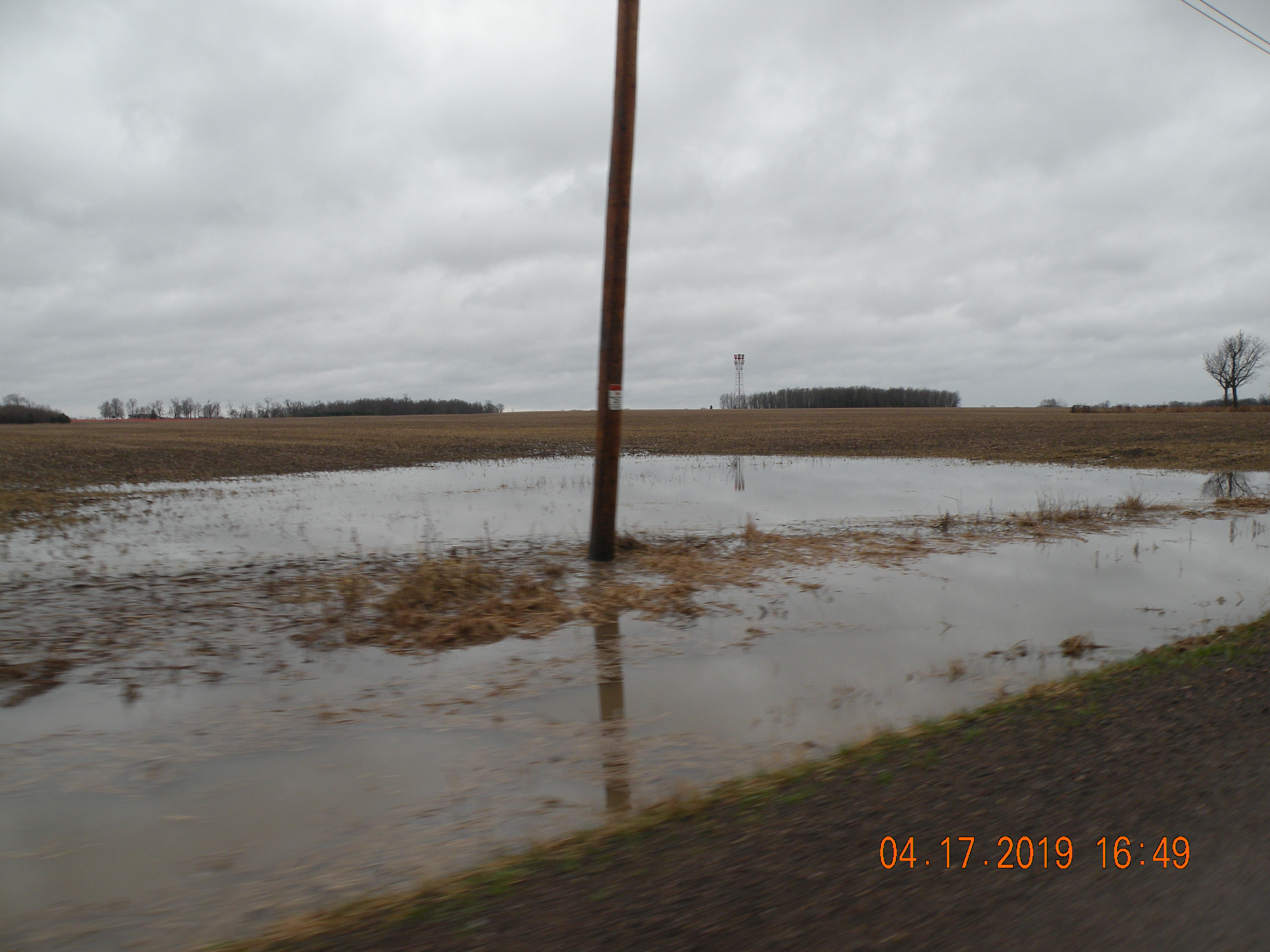
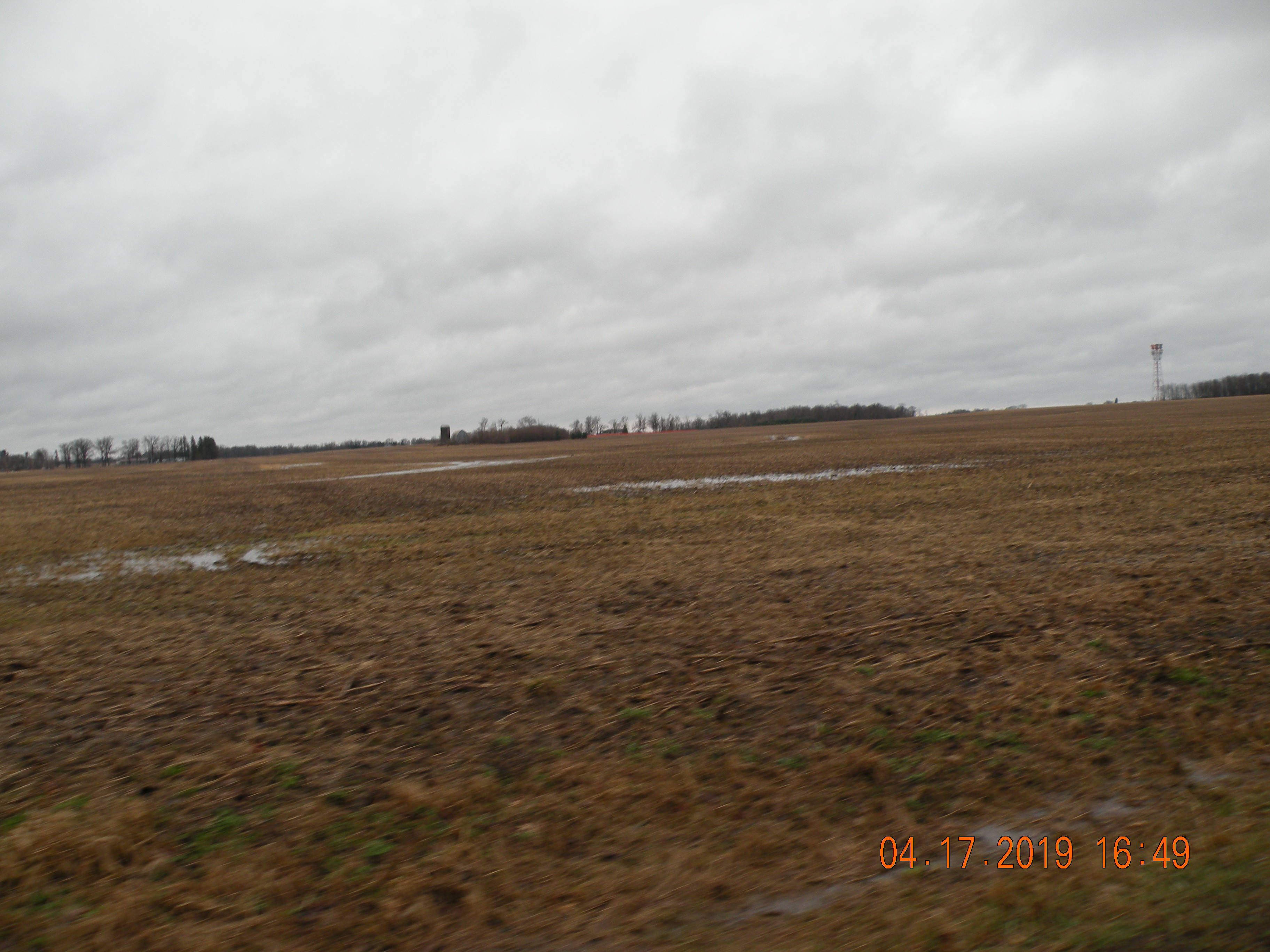
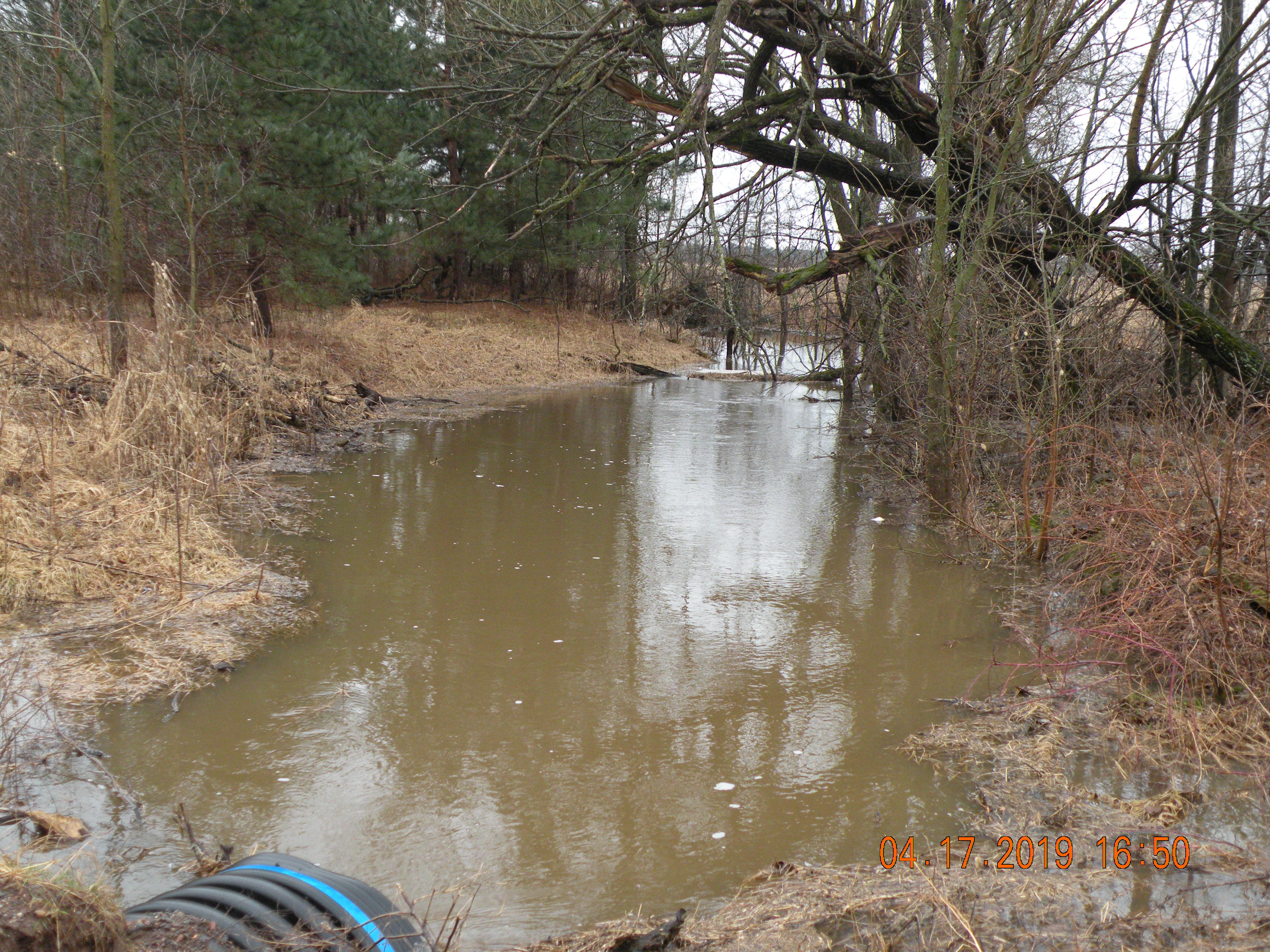
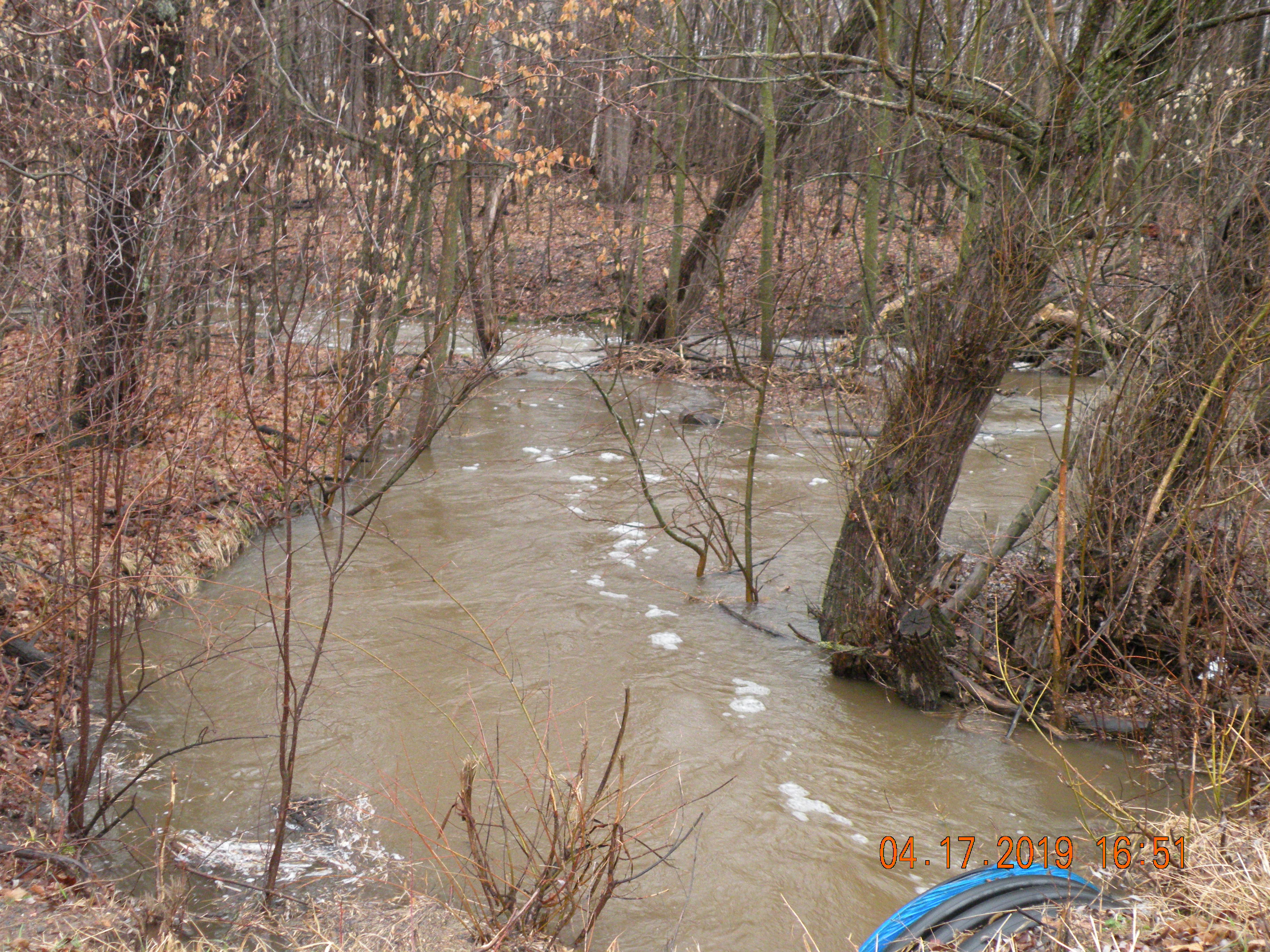
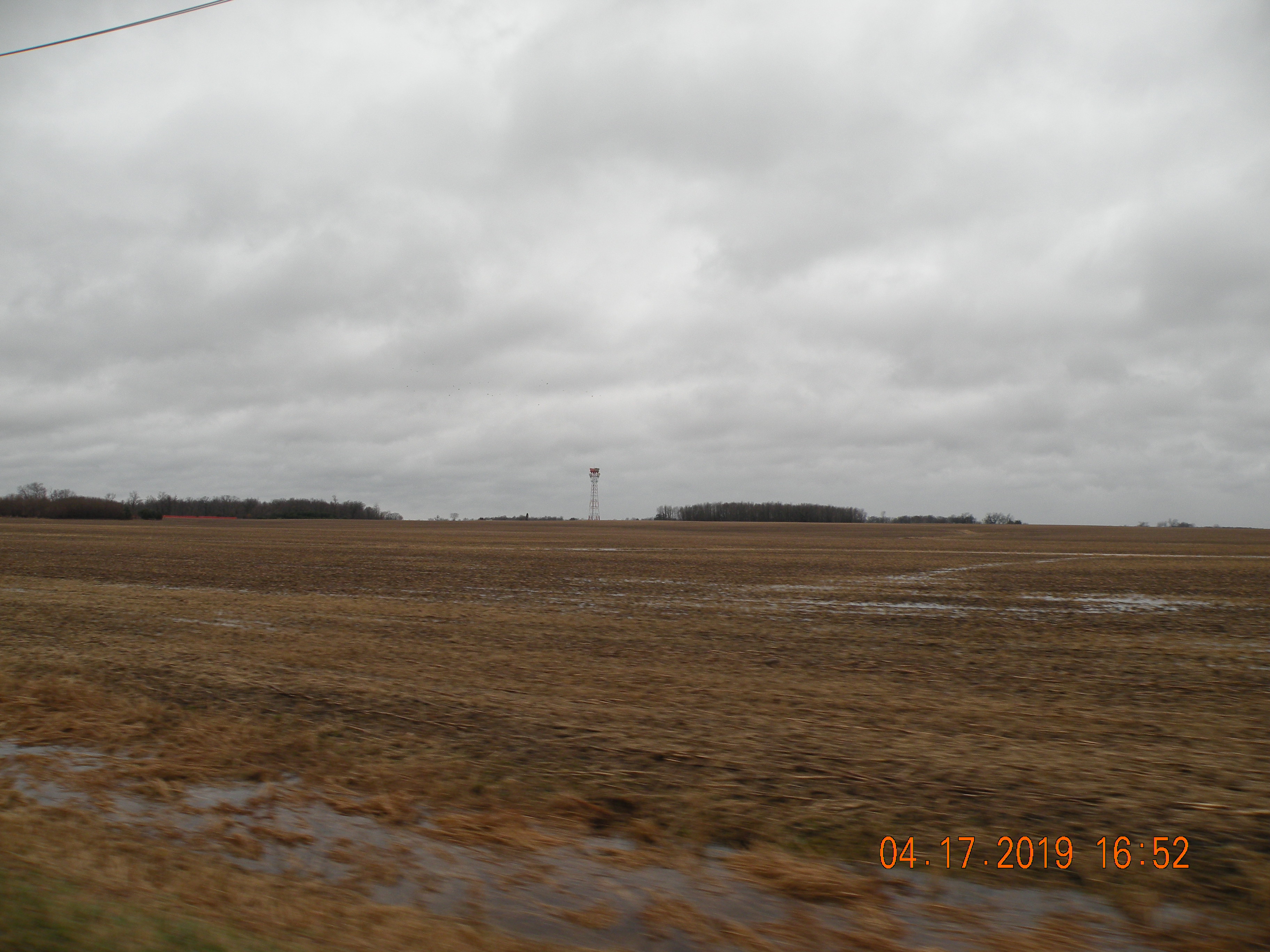
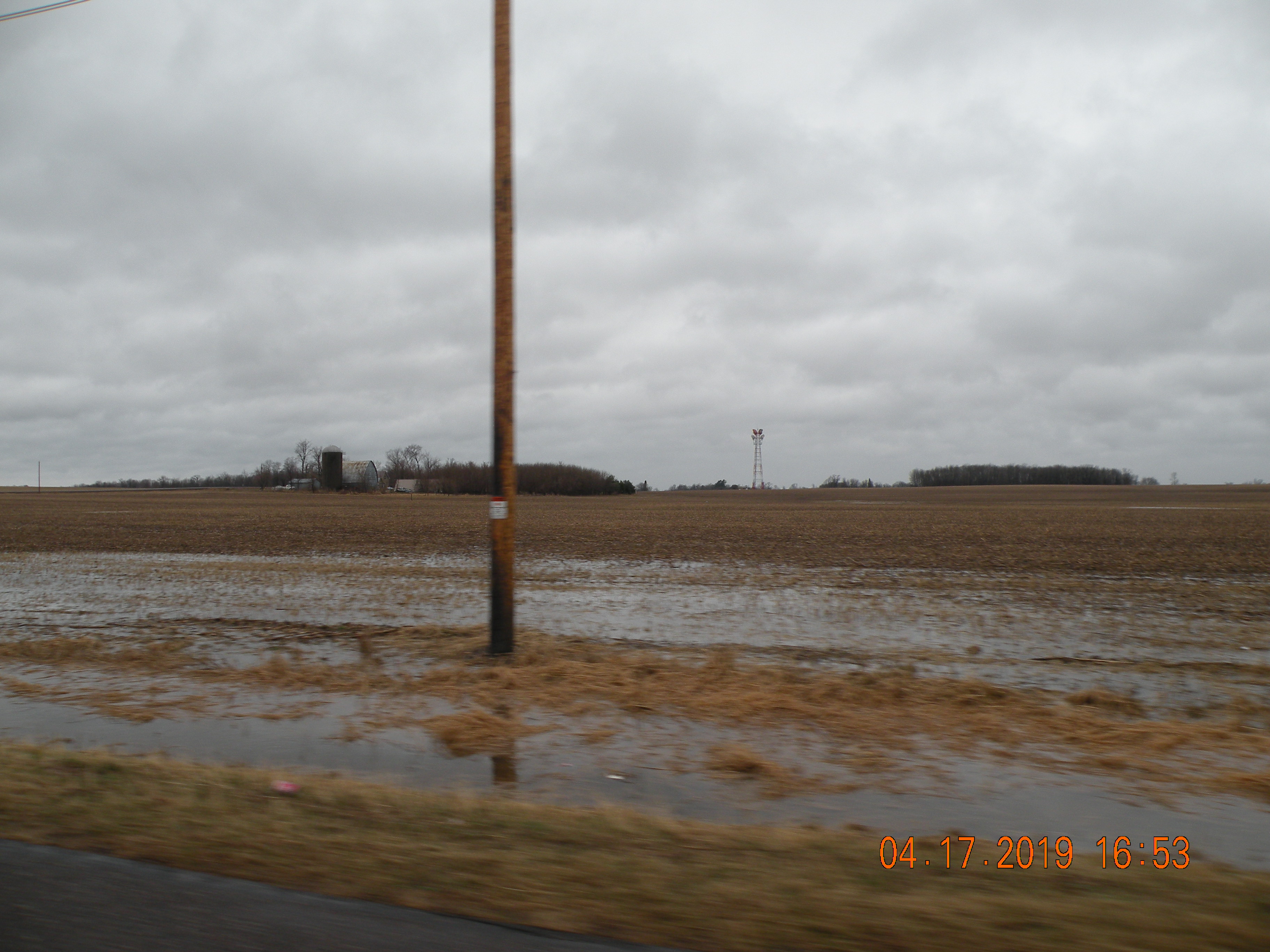
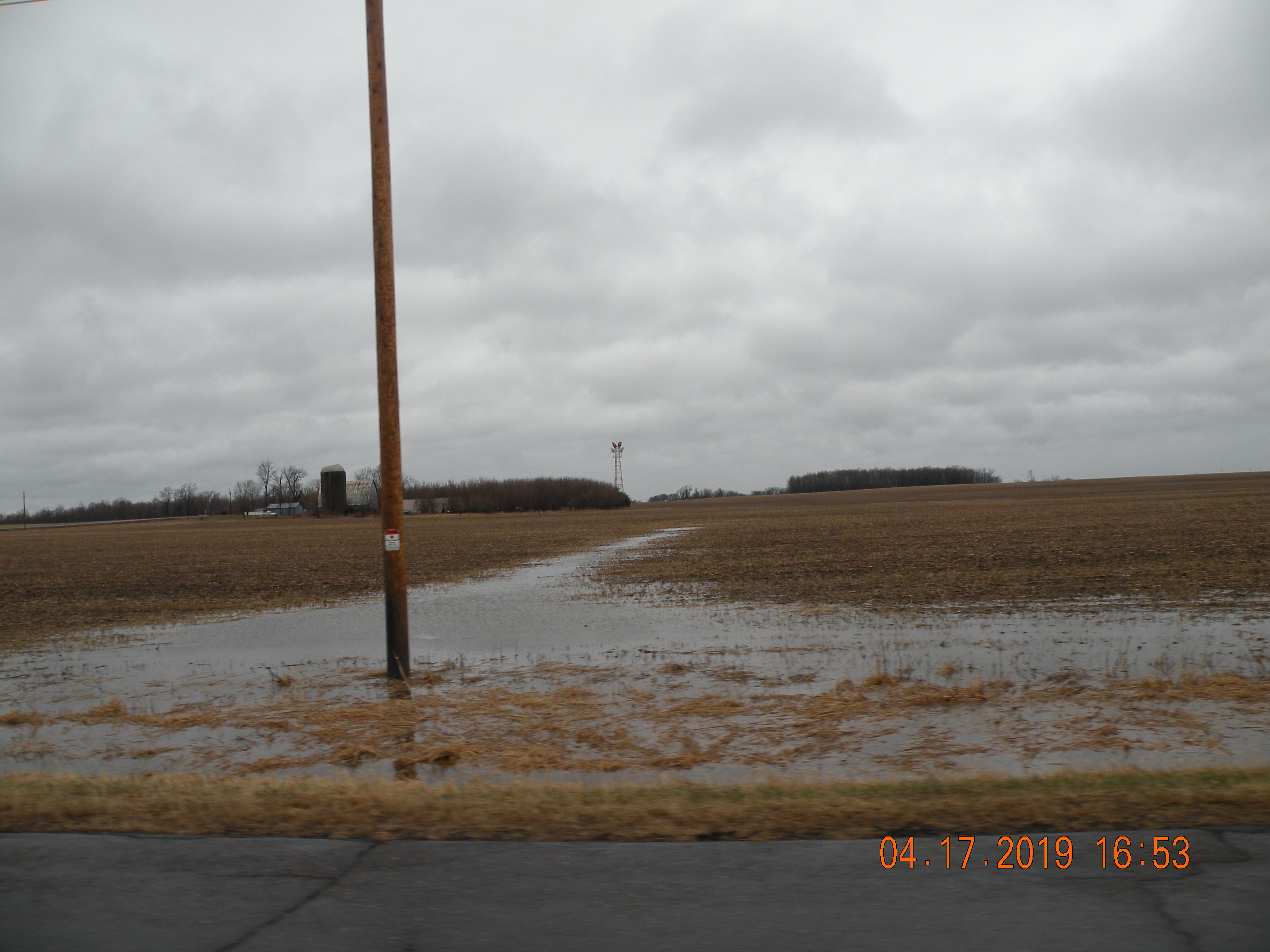
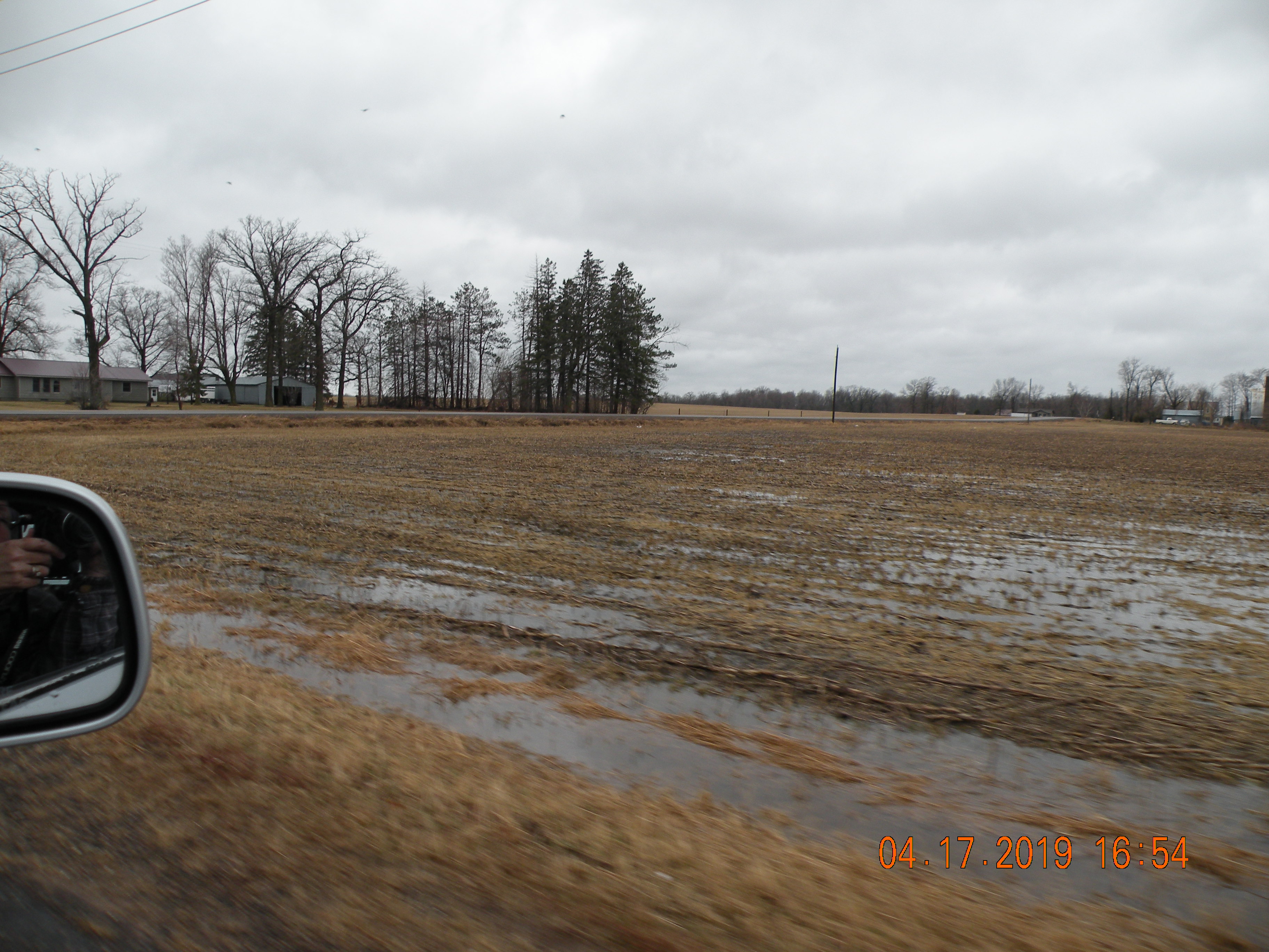
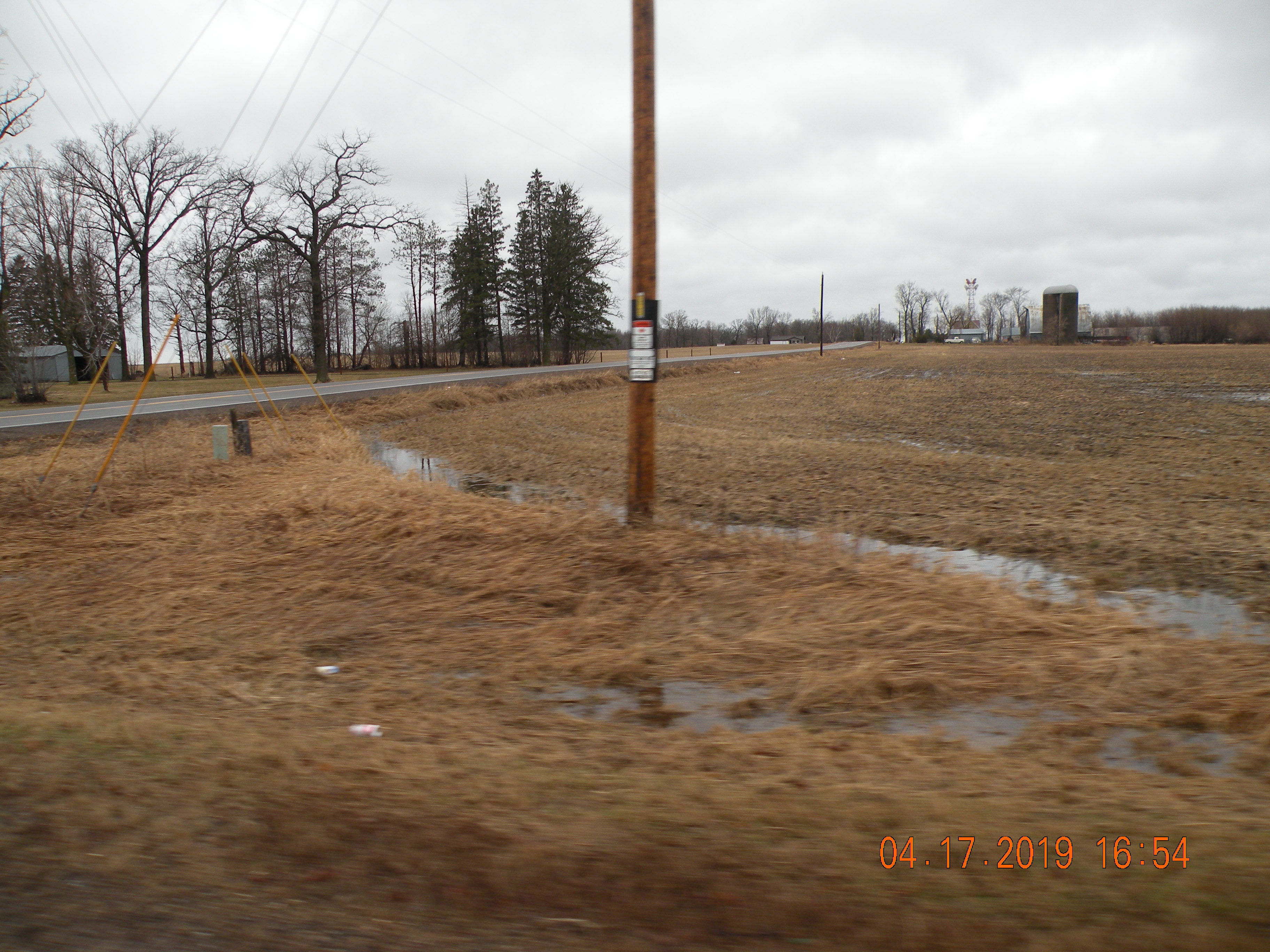
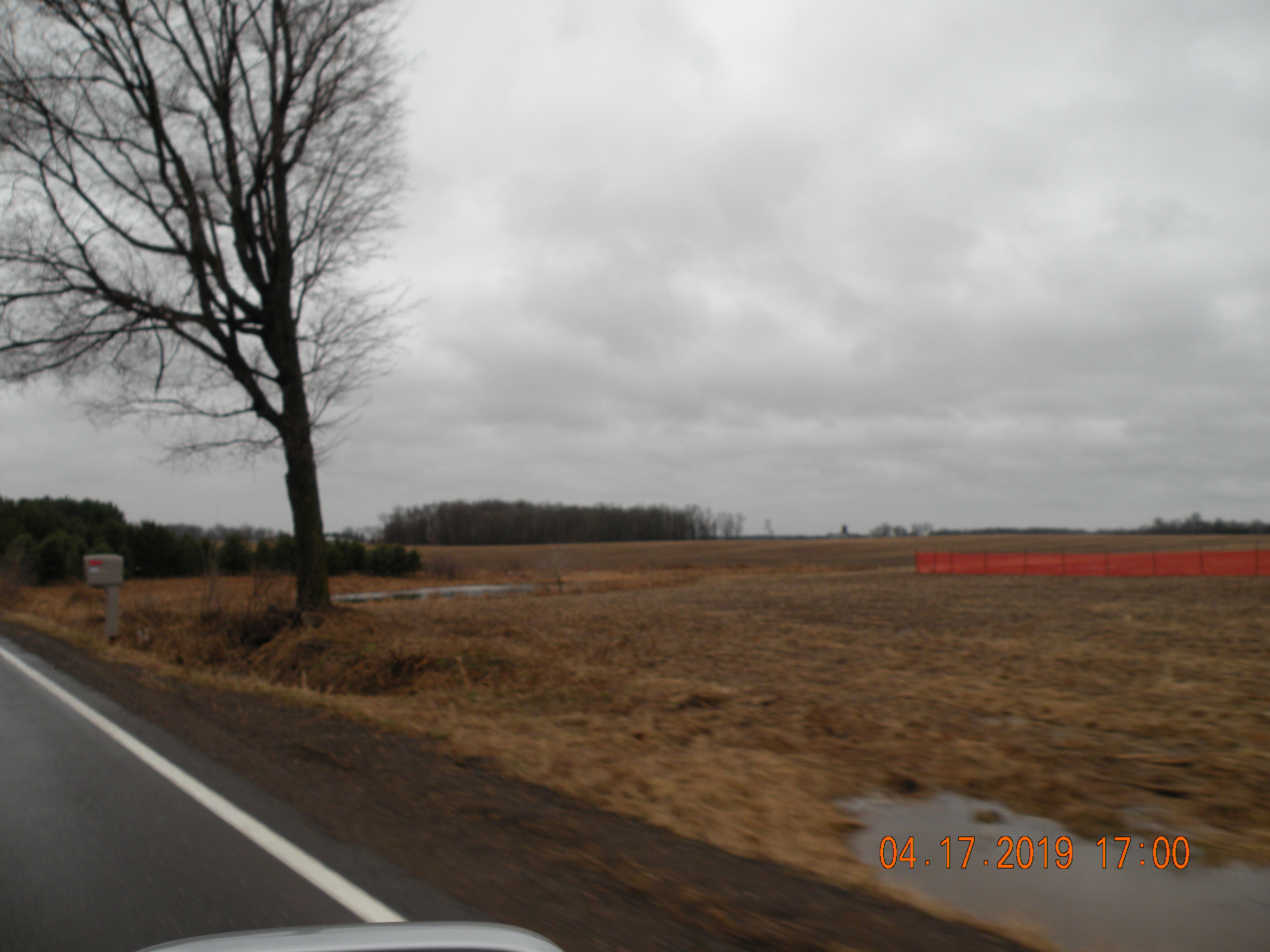
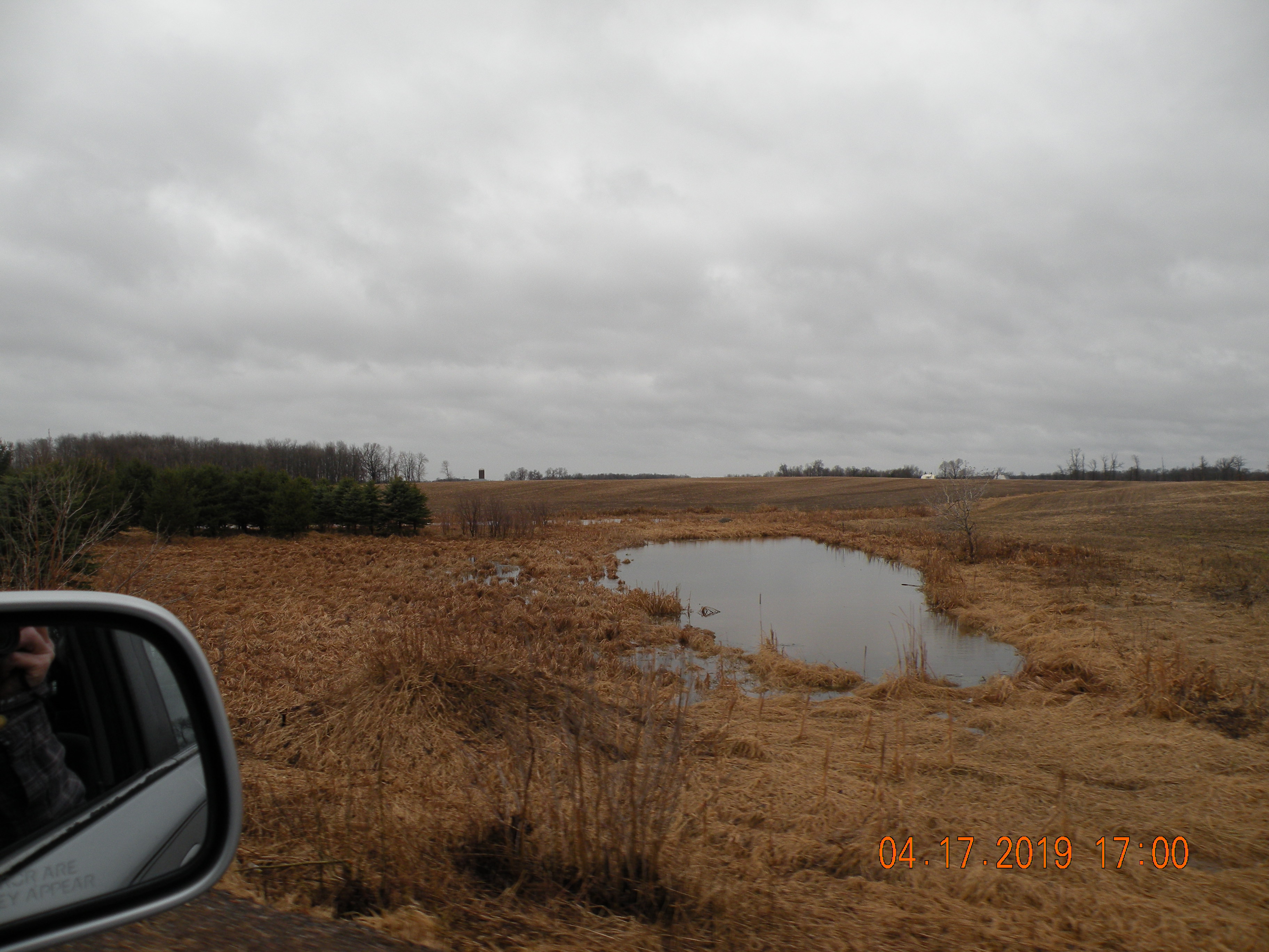
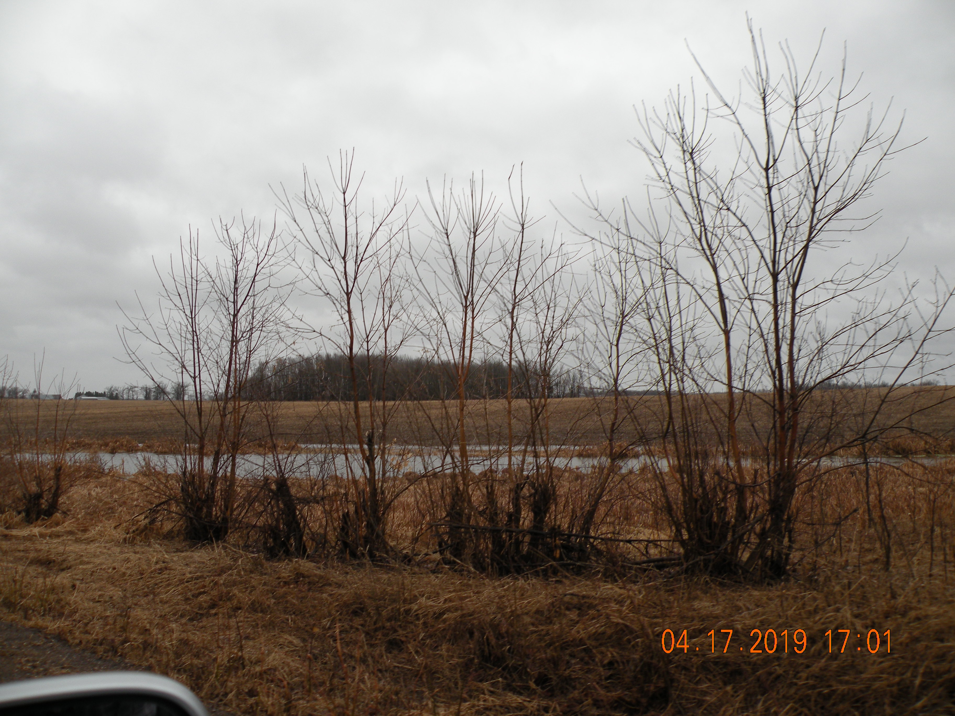
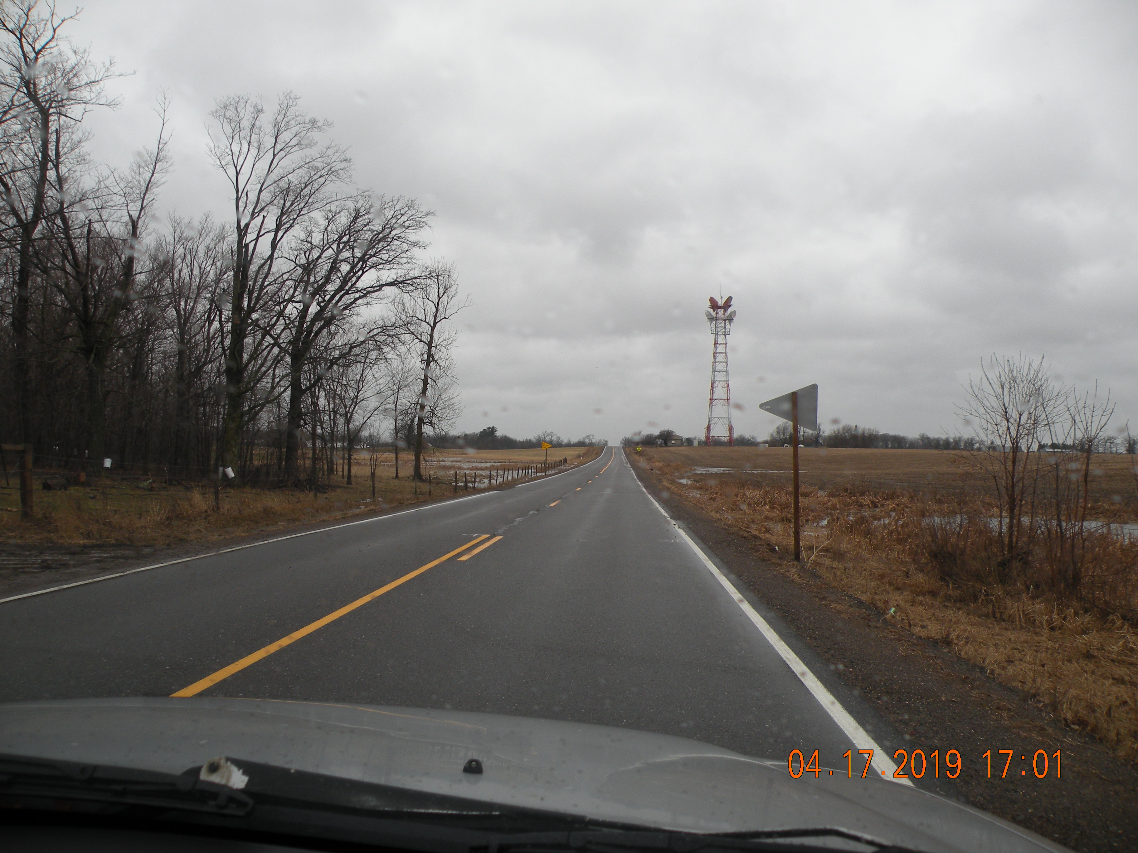
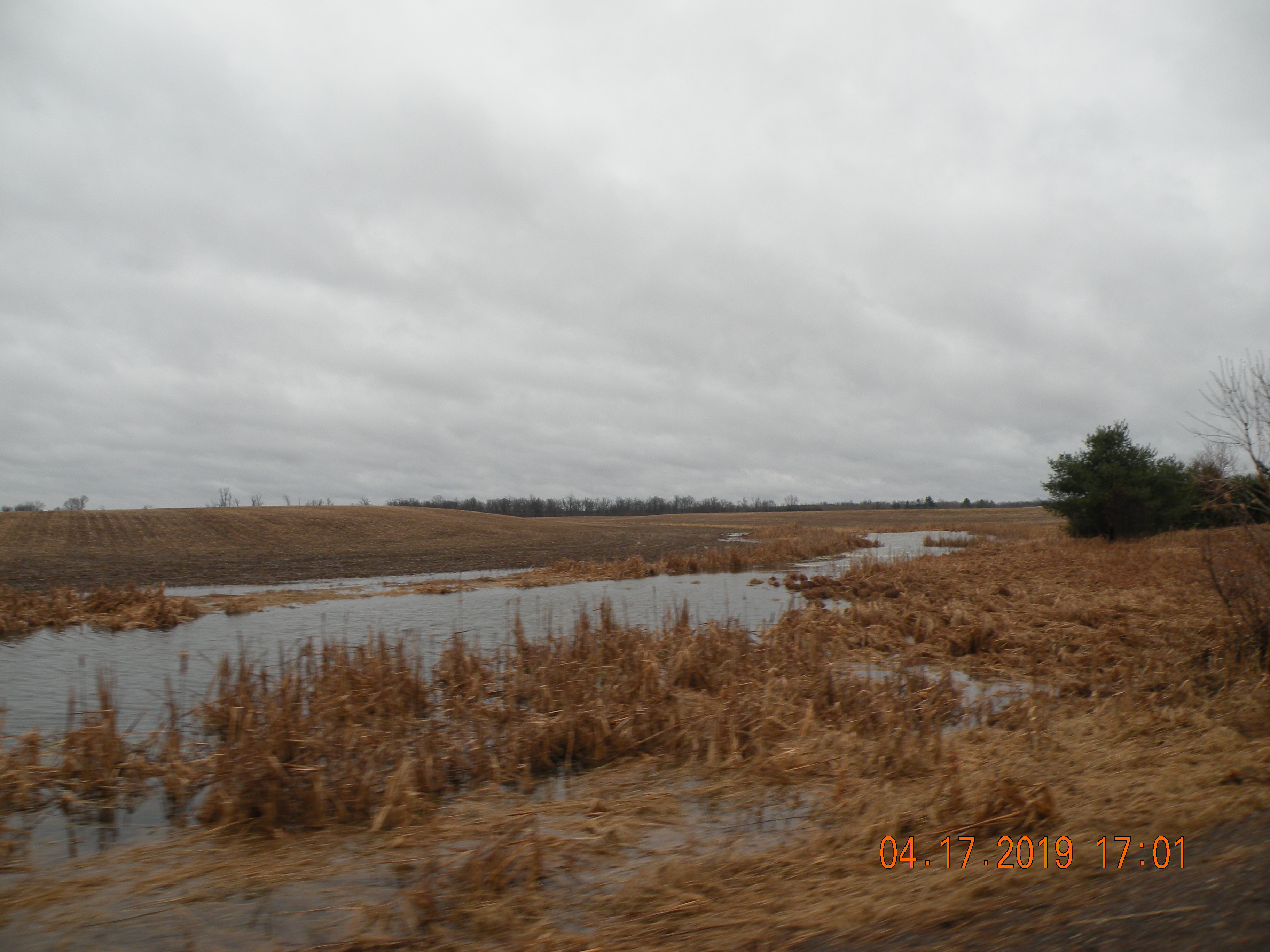
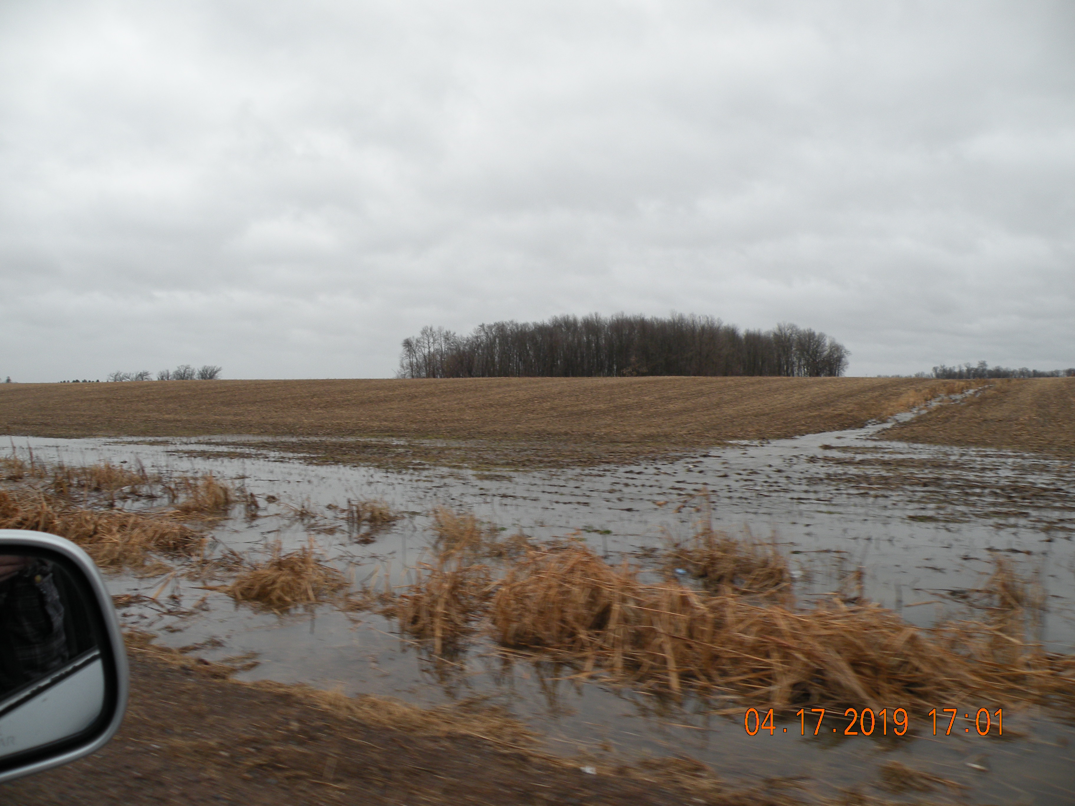
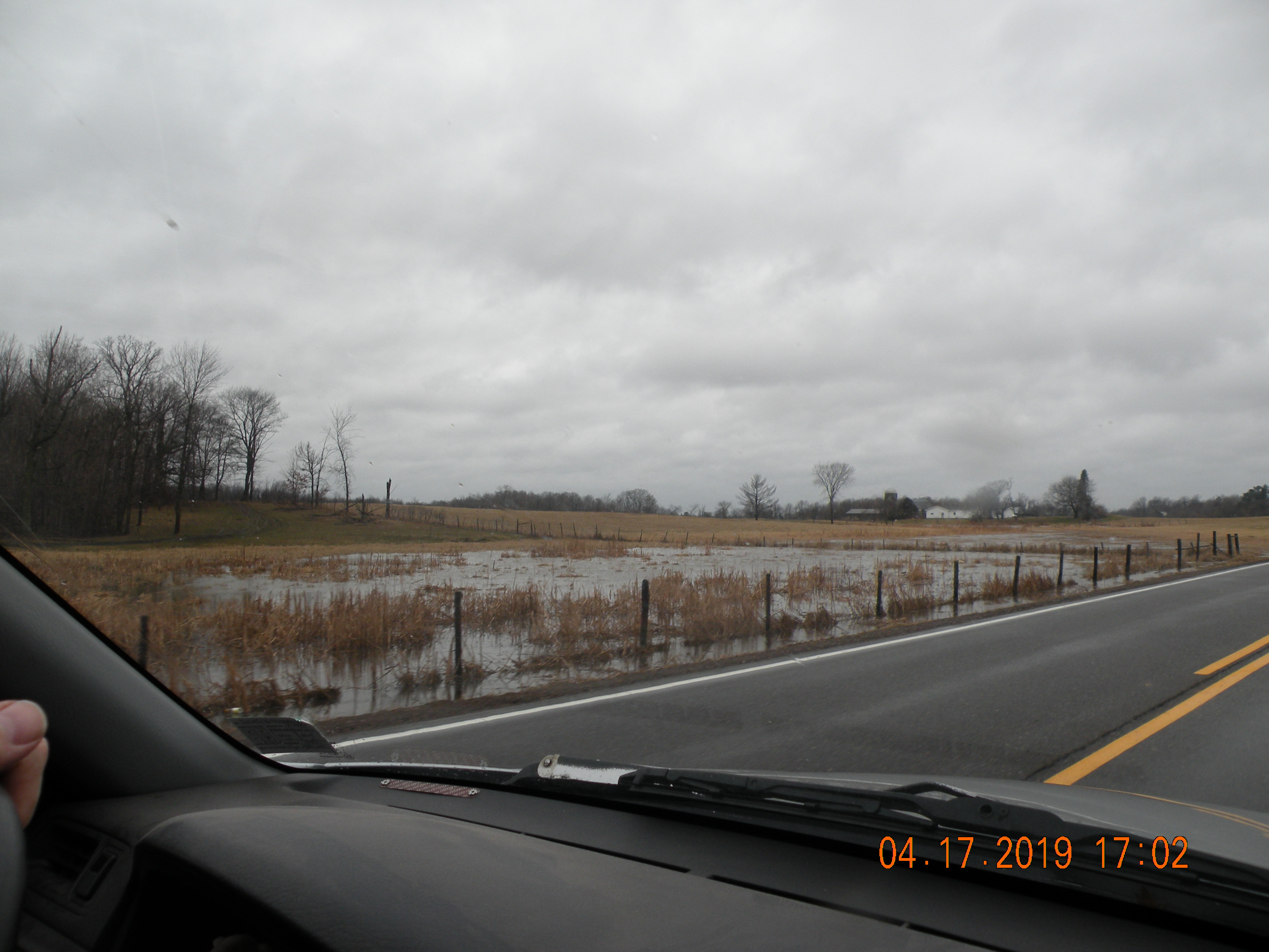
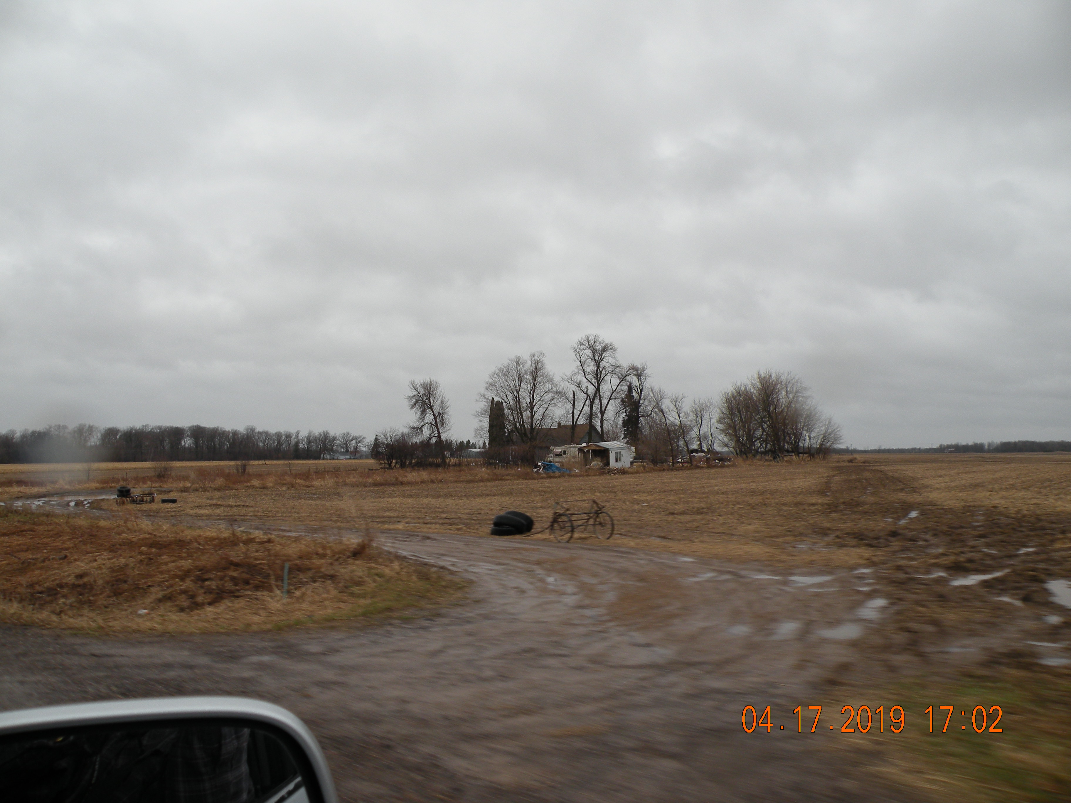
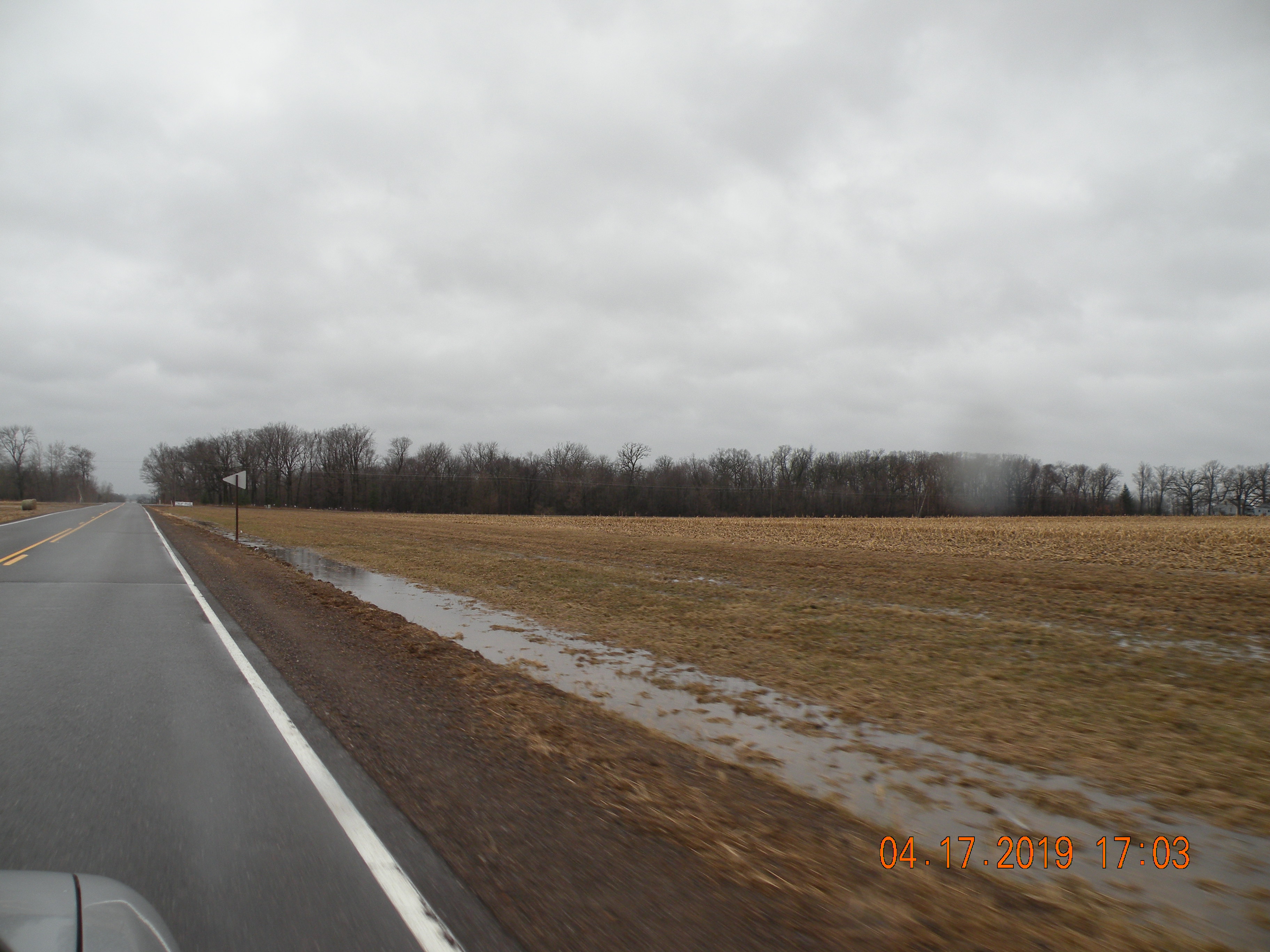
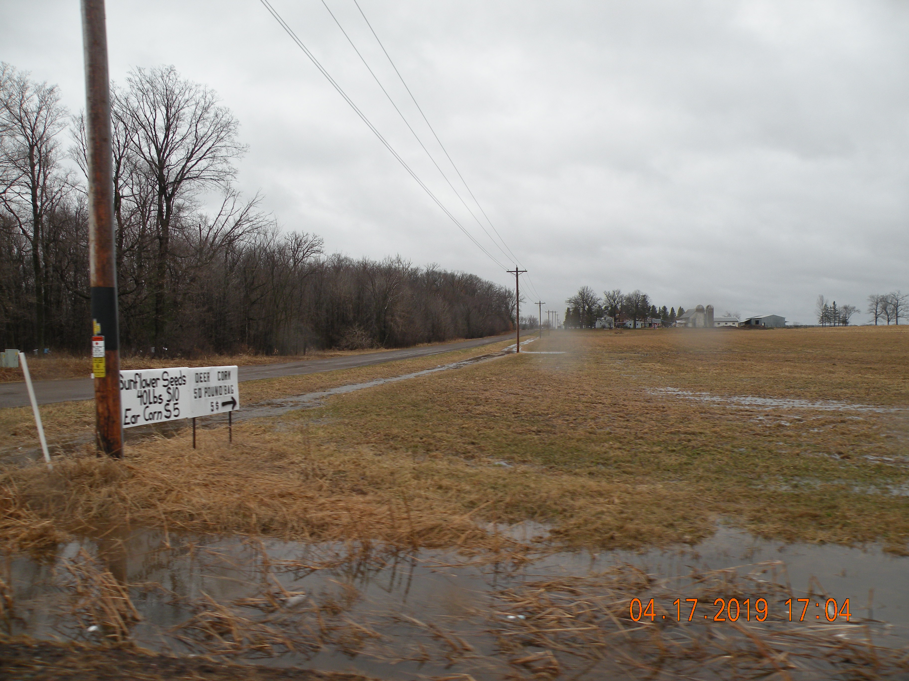
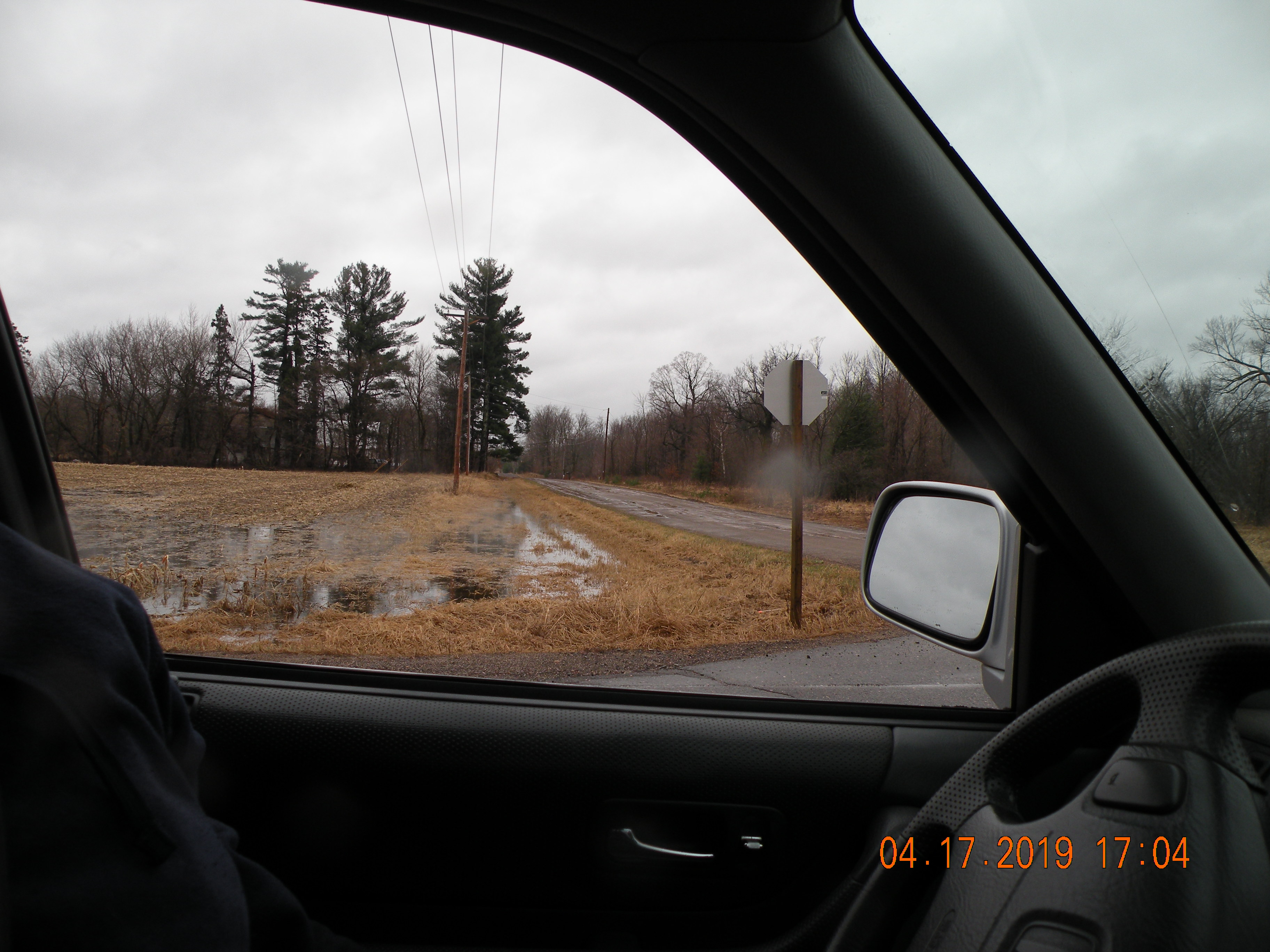
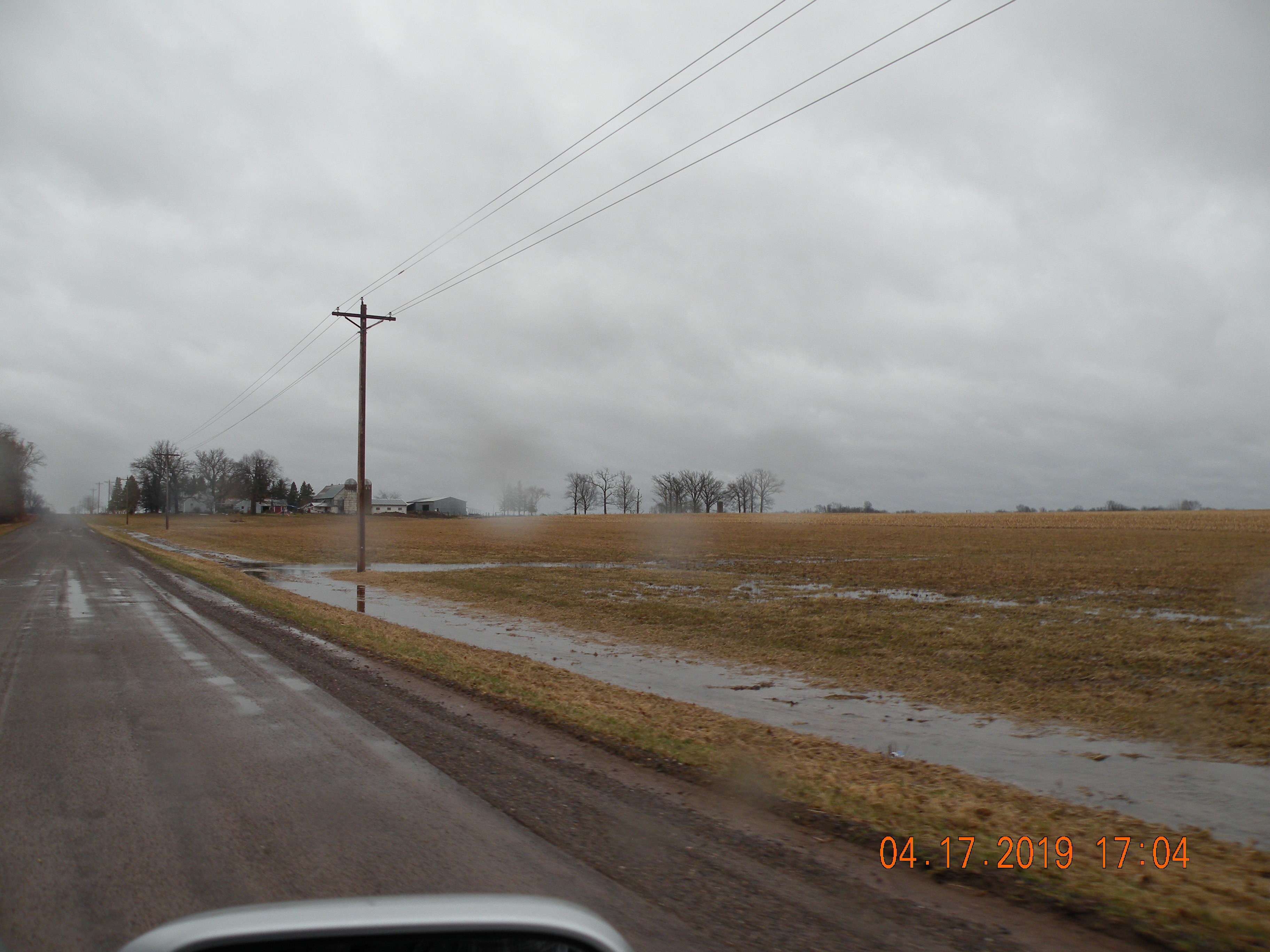
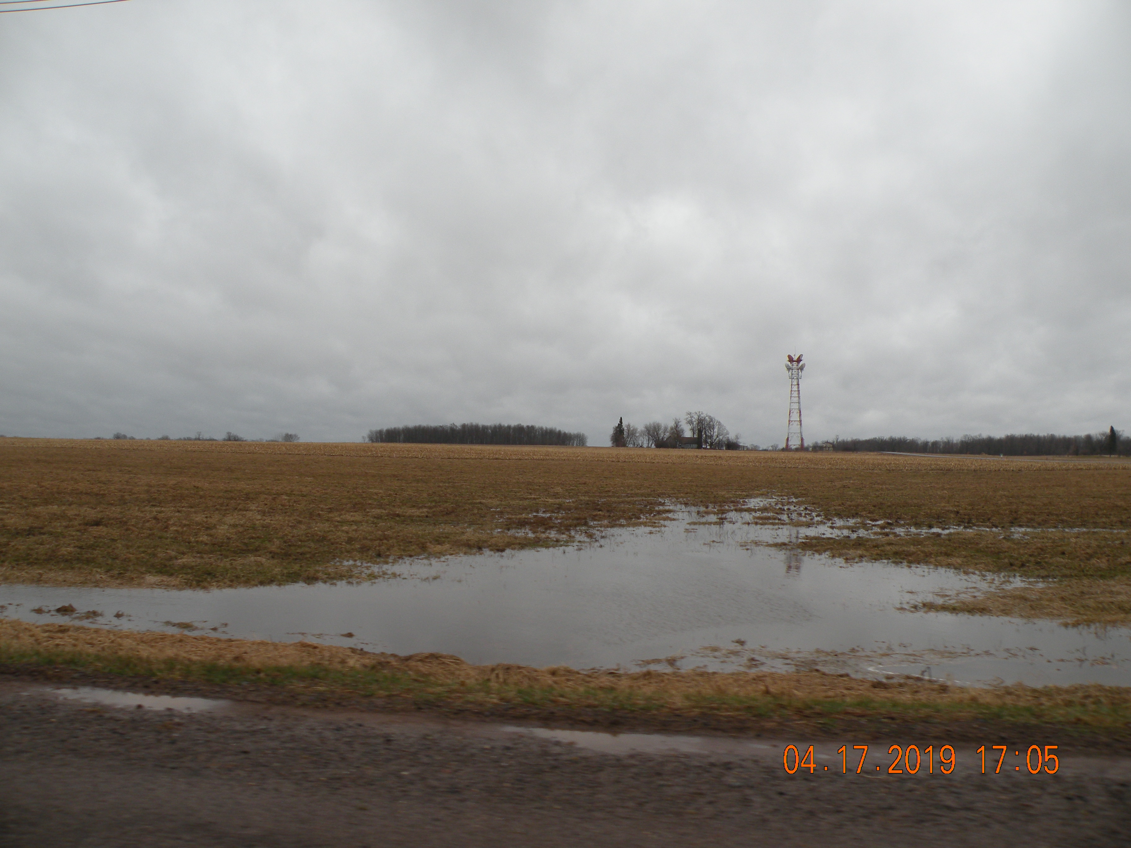
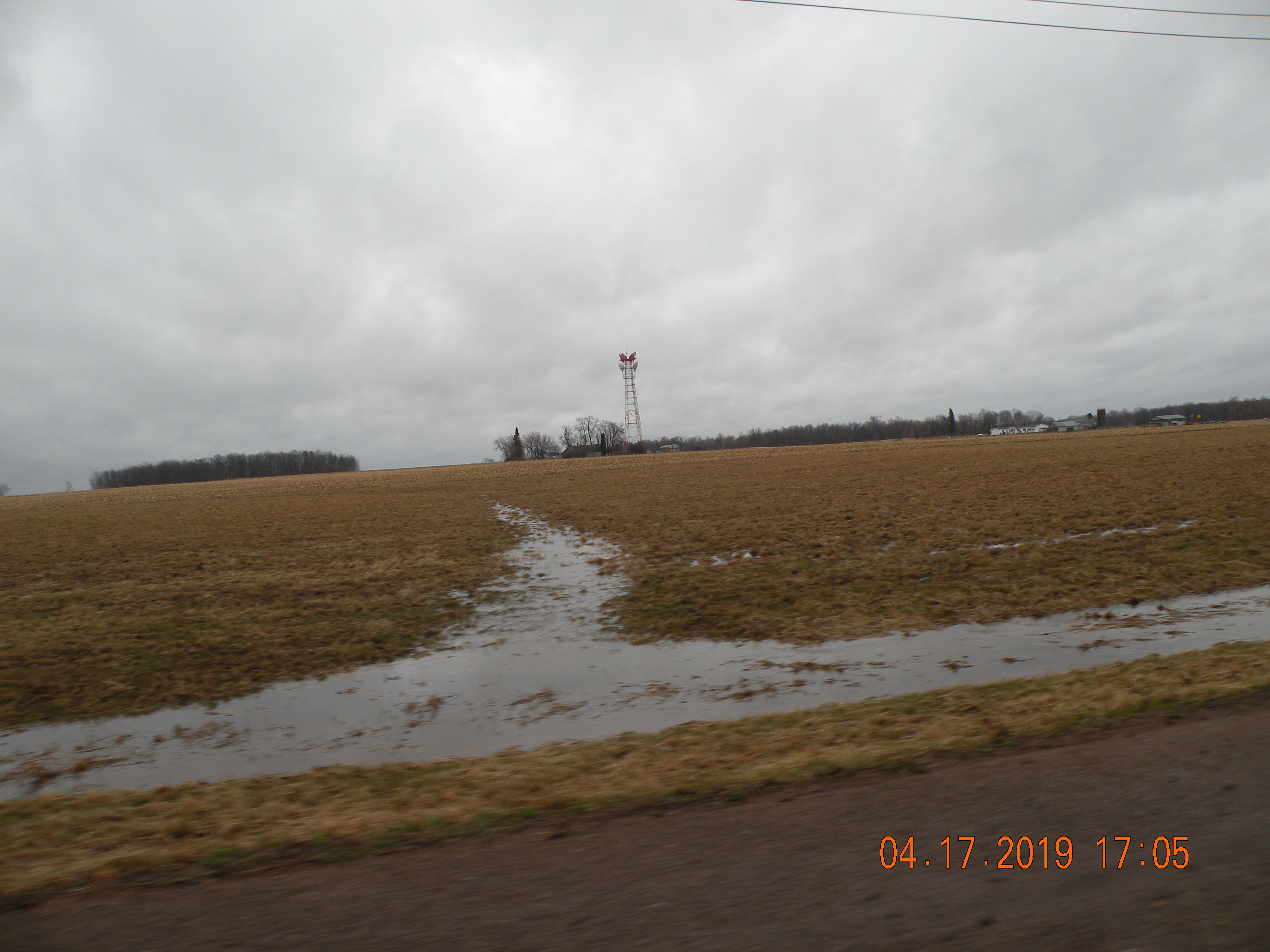
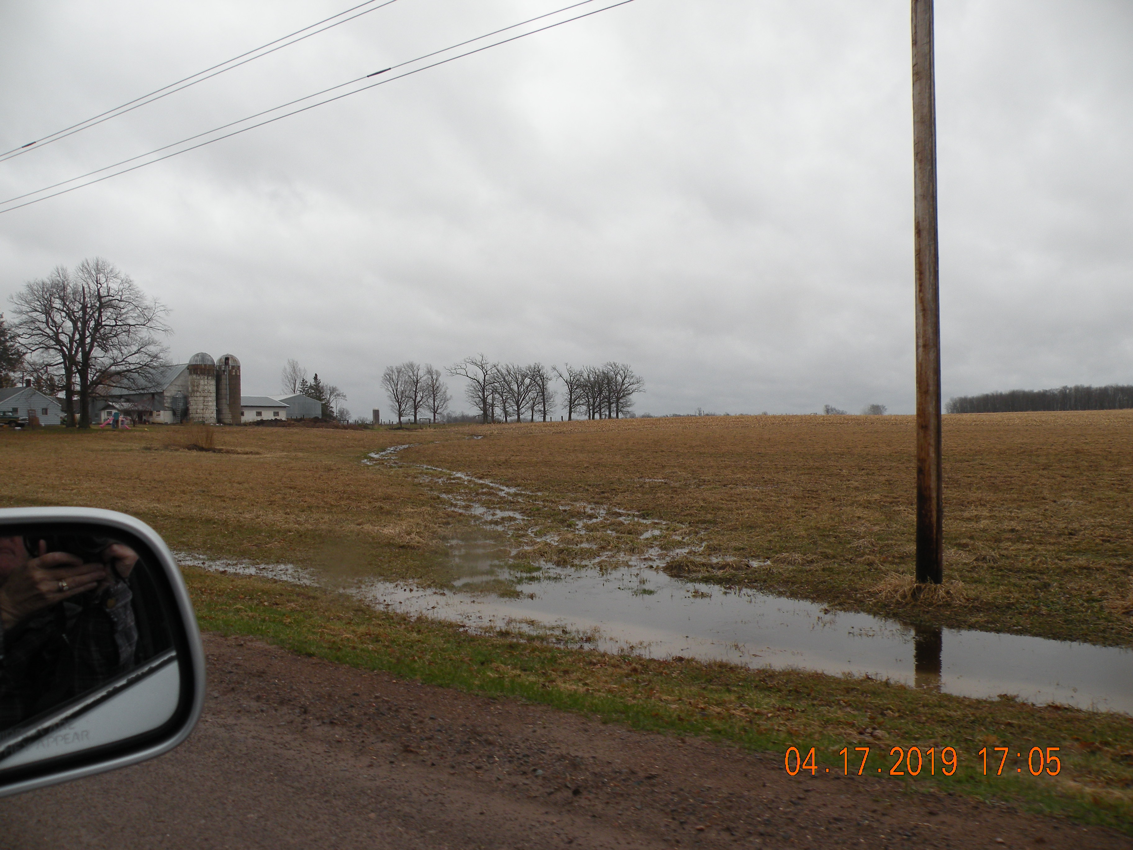
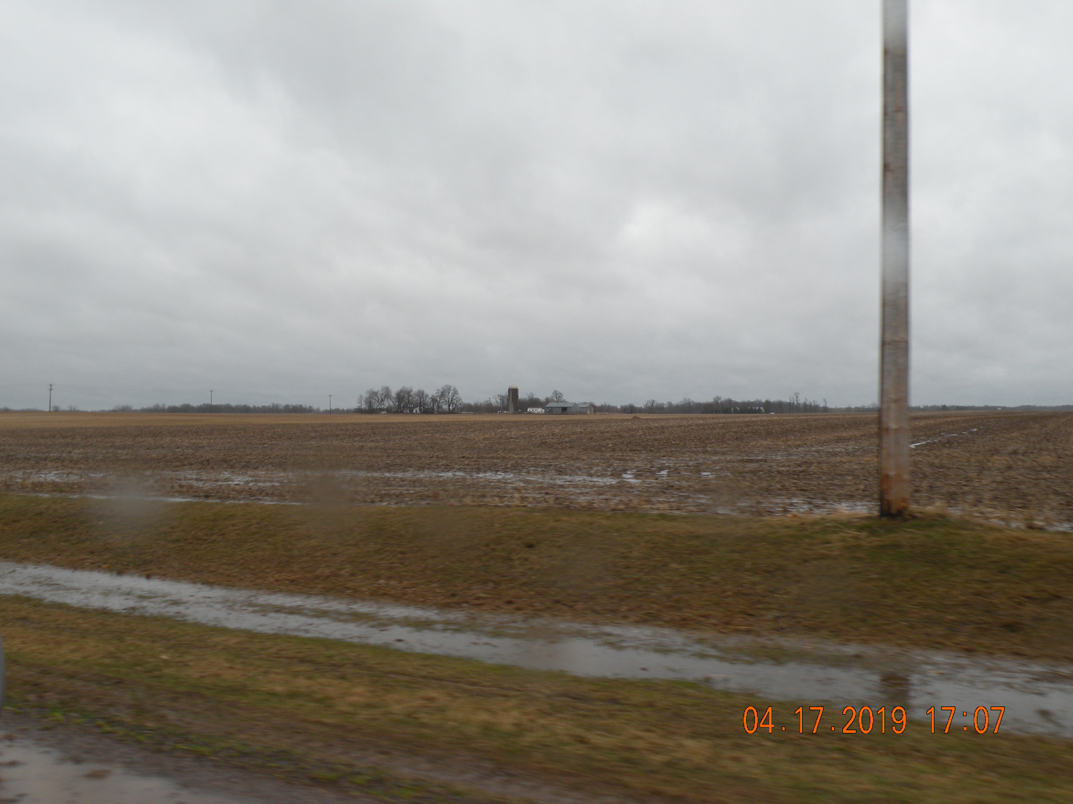
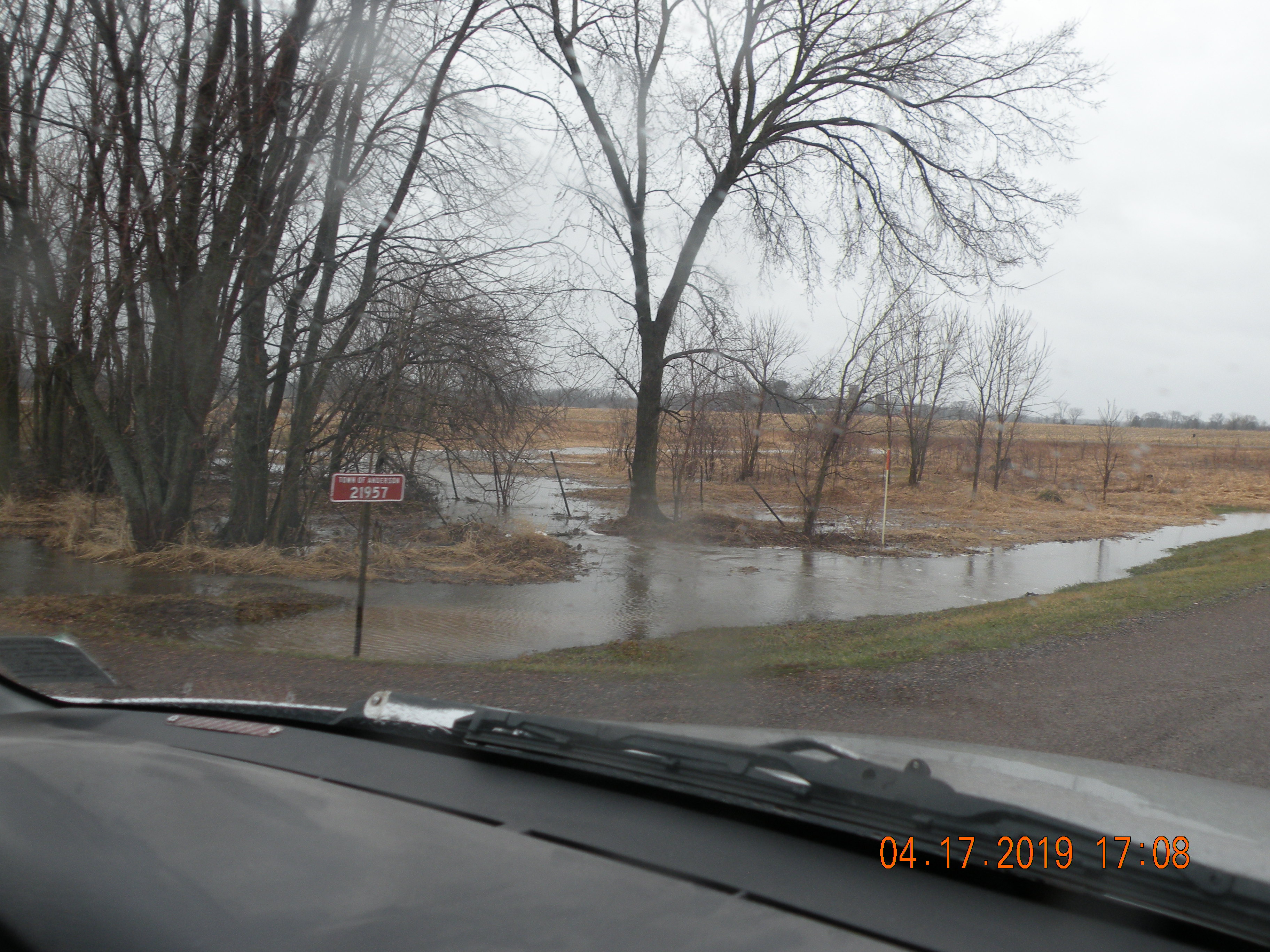
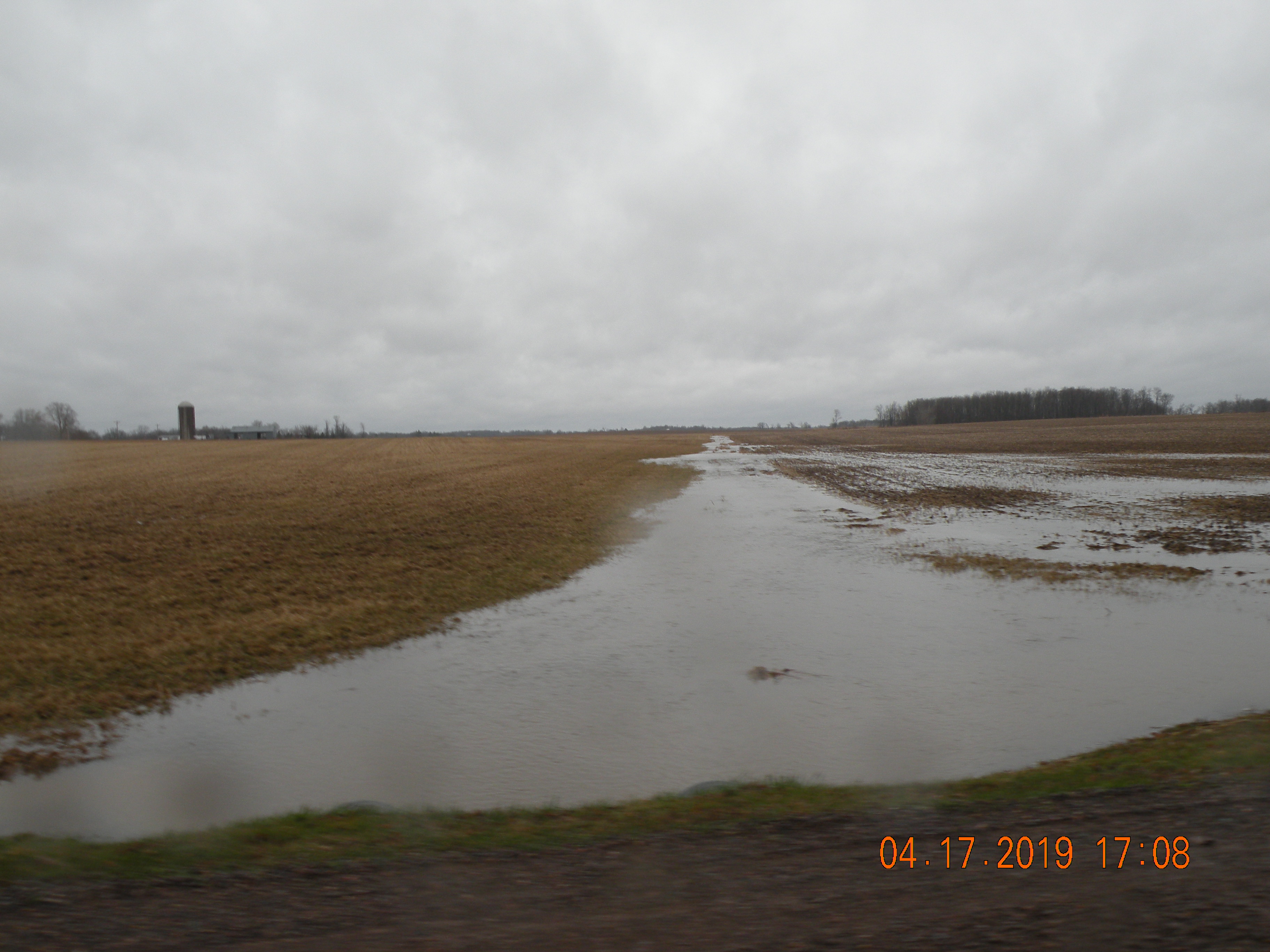
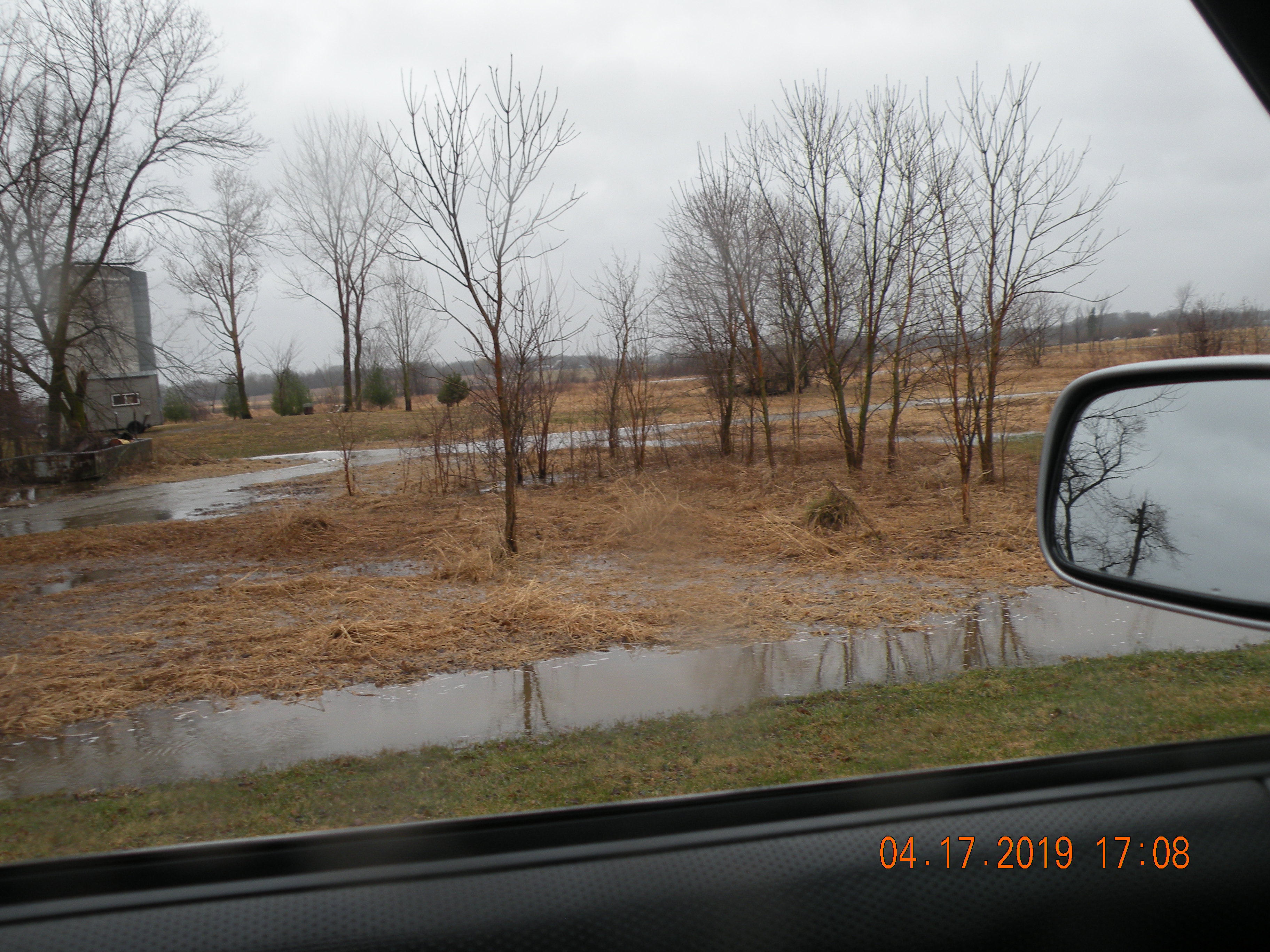
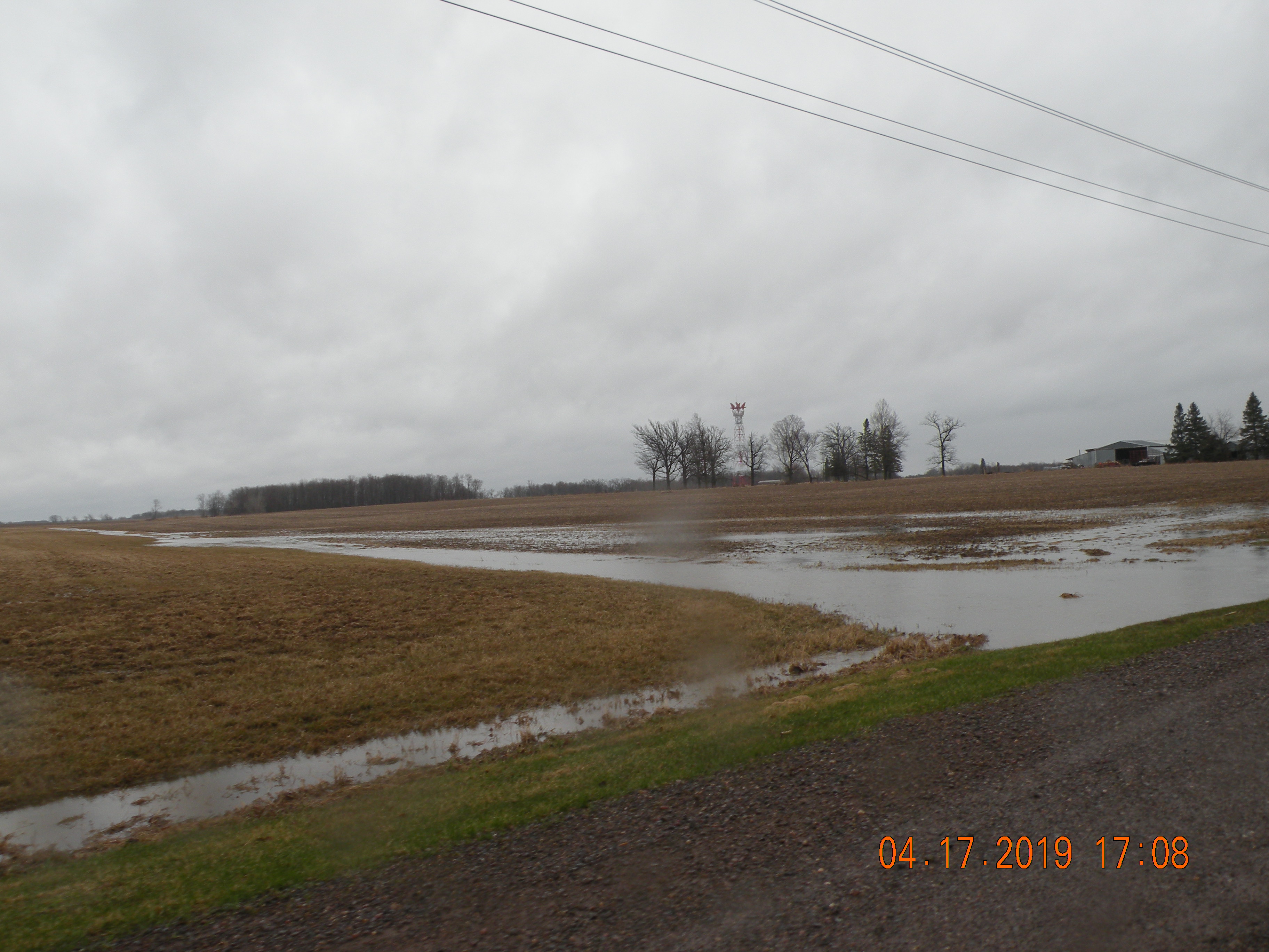
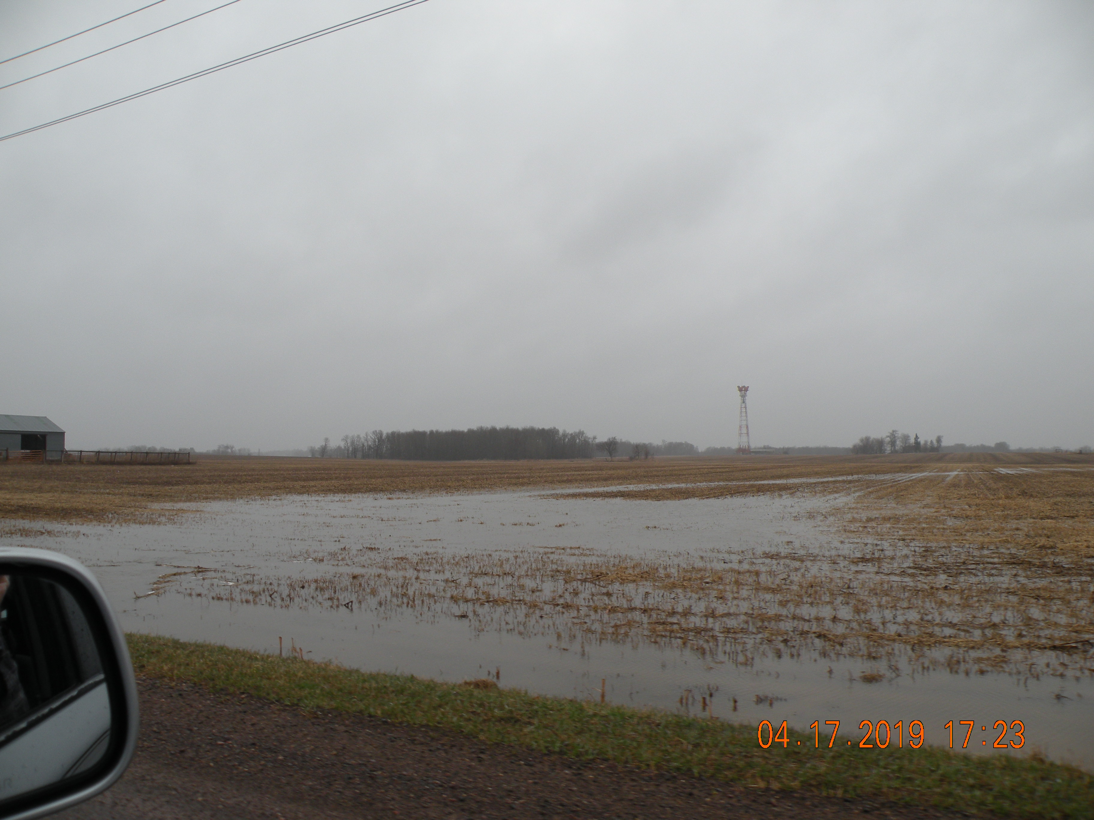
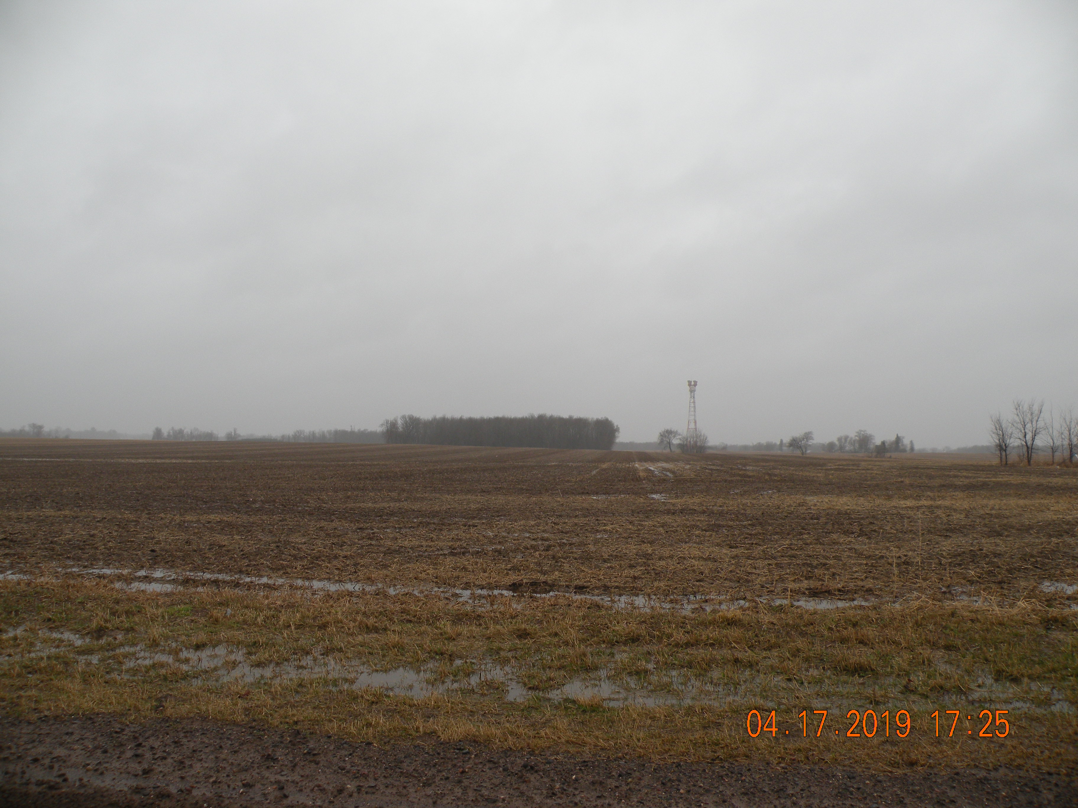
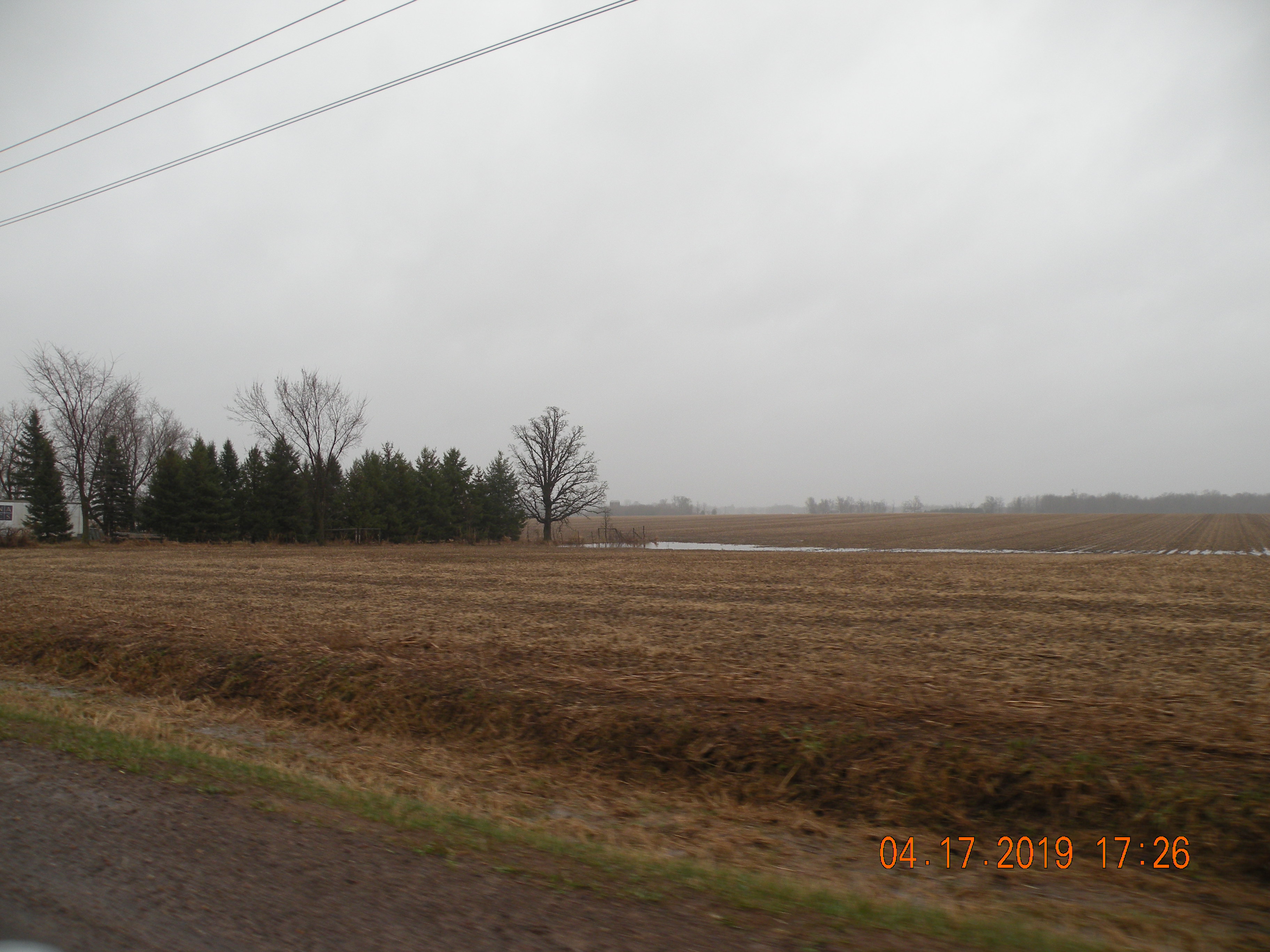
TYPICAL EXAMPLE OF RAIN WATER RUNOFF ON THE PROPERTY SURROUNDING THE LOCATION OF THE PROPOSED HOG CAFO FACILITY.
Map Graphic
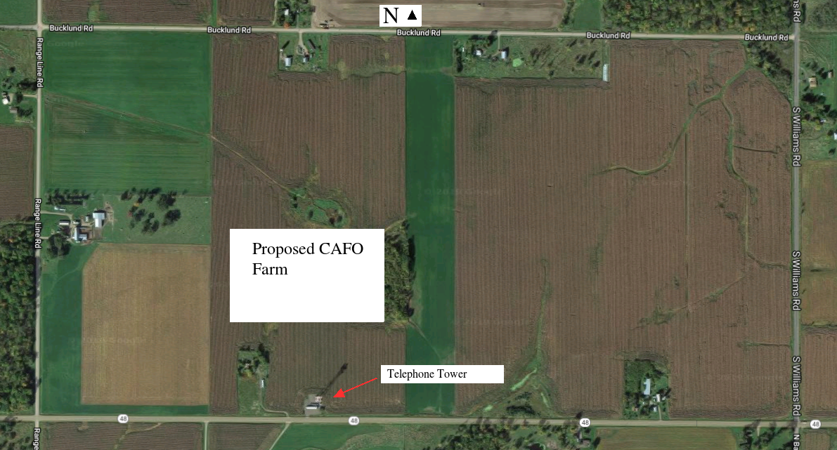
This property is bordered by Bucklund Rd. to the North, S. Williams Rd. to the East, Highway 48 to the South, and Maplewood Rd. (Border of the Town of Anderson) to the West.


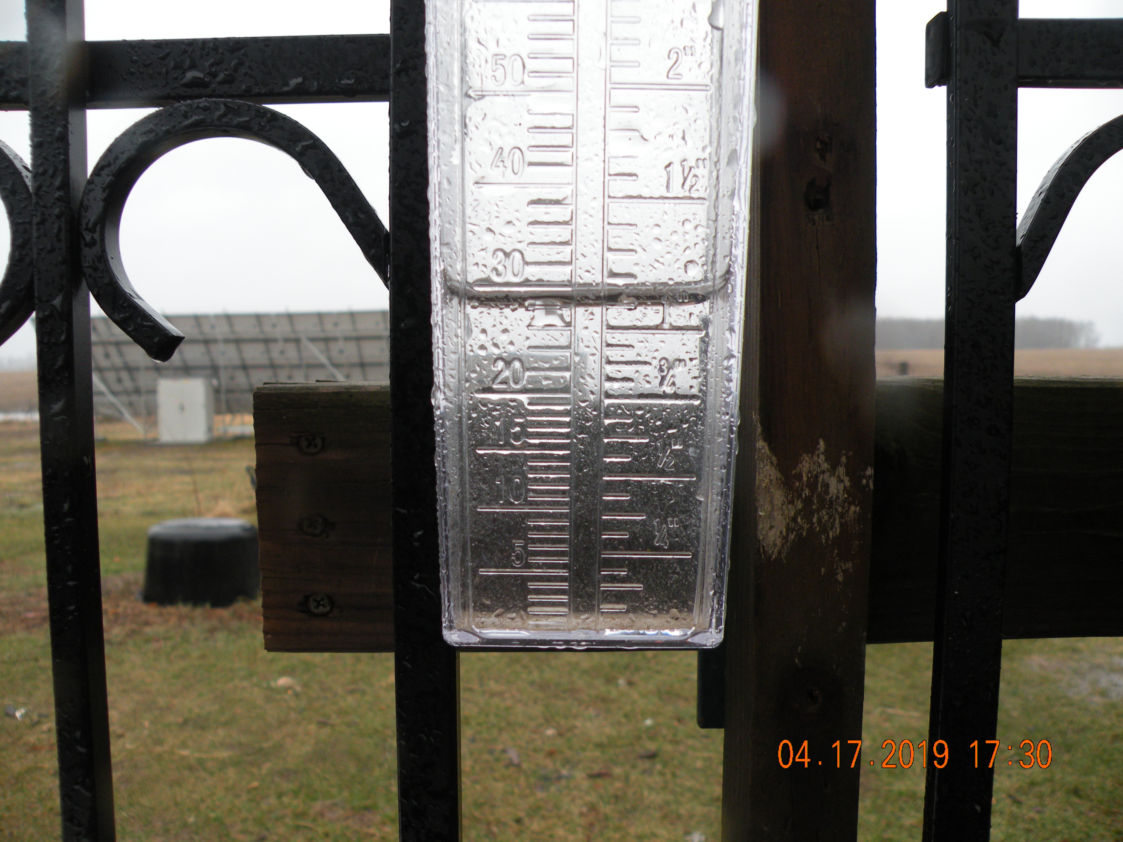
April 17, 2019 just over 1-inch of rain!
Over the coarse of the day
All pictures can clicked to view original size


DSCN0384.JPG

Our rain guage, PLEASE TAKE NOTE OF THE TIME STAMP. The picture of rain gauge was the last one taken.
Photographic Image

North edge of the property surrounding the location of the proposed Hog CAFO Facility. Bucklund Rd.


DSCN0138.JPG

Our pasture, where the runoff water enters the road ditch.
Photographic Image

DSCN0140.JPG

View of the North side of Bucklund Rd. where the water heads to Issac Lake. This is a temporary creek that allows overflow water to run off.
Photographic Image

DSCN0143.JPG

Our pasture, please take note of the telephone tower, (the location of the proposed Hog CAFO) we tried to keep the telephone tower in the picture as much as possible to help put perspective on the location.
Photographic Image

DSCN0148.JPG

Bucklund Road looking South West across surrounding property.
Photographic Image

DSCN0150.JPG

Bucklund Road looking more South.
Photographic Image

DSCN0155.JPG

Bucklund Road, a more permanent creek on the North East corner of the surrounding property, that runs to Issac lake.
Photographic Image

DSCN0159.JPG

North side of Bucklund Road, water exiting the culvert and heading to Issac Lake.
Photographic Image


East edge of the property surrounding the location of the proposed Hog CAFO Facility. South Williams Rd.

DSCN0164.JPG

S. Williams Road. North east corner of surrounding property, looking mostly West and South.
Photographic Image

DSCN0168.JPG

S. Williams Road, looking mostly West, another temporary overflow runoff drain, that leads into the previously mentioned creek.
Photographic Image

DSCN0172.JPG

S. Williams Road, about midway of the East edge of the surrounding property, looking mostly West.
Photographic Image

DSCN0174.JPG

S. Williams Road, another runoff channel.
Photographic Image

DSCN0177.JPG

S. Williams Road, South East corner of the Surrounding property, where S. Williams meets Highway 48.
Photographic Image

DSCN0179.JPG

Another view of the South East corner of the surrounding property.
Photographic Image


South edge of the property surrounding the location of the proposed Hog CAFO Facility. Highway 48.

DSCN0197.JPG

Highway 48, looking mostly West, and slightly North.
Photographic Image

DSCN0199.JPG

Highway 48, looking mostly North. Wetlands low area, where water normally runs too.
Photographic Image

DSCN0201.JPG

Highway 48, West side of the low area mentioned above.
Photographic Image

DSCN0202.JPG

Highway 48, low land areas, on both sides of the road. Water runs off of the Surrounding property, South to the neighboring property.
Photographic Image

DSCN0206.JPG

Highway 48, another view of the low area, looking North and slightly East.
Photographic Image

DSCN0209.JPG

Highway 48, looking North, and slightly West at the actual property of the proposed Hog CAFO facility.
Photographic Image

DSCN0213.JPG

Highway 48, view of the South side of 48 where water is running onto the neighboring property.
Photographic Image

DSCN0215.JPG

Highway 48, view of East edge of actual property of the proposed Hog CAFO facility.
Photographic Image

DSCN0221.JPG

Highway 48, looking mostly West over the South West corner of the surrounding property.
Photographic Image

DSCN0225.JPG

Highway 48, looking north along the South West edge of the surrounding property.
Photographic Image

DSCN0227.JPG

Highway 48, looking South across the Highway, at the neighboring property, of the South West Corner of the Surrounding property.
Photographic Image


West edge of the property surrounding the location of the proposed Hog CAFO Facility. Maplewood Rd. Also borders Town of Anderson.

DSCN0230.JPG

Maplewood Road, again looking mostly North, and slightly East, at the South West corner of the surrounding property.
Photographic Image

DSCN0233.JPG

Maplewood Road, looking East across the South West part of the Surrounding Area.
Photographic Image

DSCN0236.JPG

Maplewood Road, another runoff channel on the South West part of the Surrounding Area.
Photographic Image

DSCN0238.JPG

Approximately midway on Maplewood Road, looking North East.
Photographic Image

DSCN0245.JPG

Maplewood Road moving toward the North West corner of the surrounding property. Looking mostly East and slightly North.
Photographic Image

DSCN0251.JPG

Maplewood Road, looking North West, over neighboring property on the West side of Maplewood Road, (Town of Anderson).
Photographic Image

DSCN0252.JPG

Maplewood Road, Looking East and slightly South. This runoff channel would come from almost directly off the North edge of the proposed Hog CAFO facility.
Photographic Image

DSCN0254.JPG

Maplewood Road, another view of the neighboring property on the West side of Maplewood Road.
Photographic Image

DSCN0256.JPG

Maplewood Road, another view showing the runoff channel in perspective to the telephone tower. View is looking South East across surrounding property.
Photographic Image


North edge of the property surrounding the location of the proposed Hog CAFO Facility. Bucklund Rd.

DSCN0343.JPG

Back on Bucklund Road, looking almost straight South. The proposed Hog CAFO facility would be between this location and the telephone tower.
Photographic Image

DSCN0358.JPG

Bucklund Road, another view looking directly South from the North edge of the Surrounding property.
Photographic Image

DSCN0371.JPG

Bucklund Road, view of water runoff channel the runs directly on to our property, just to the south of our house.
Photographic Image